Maps: 1901 - 1921

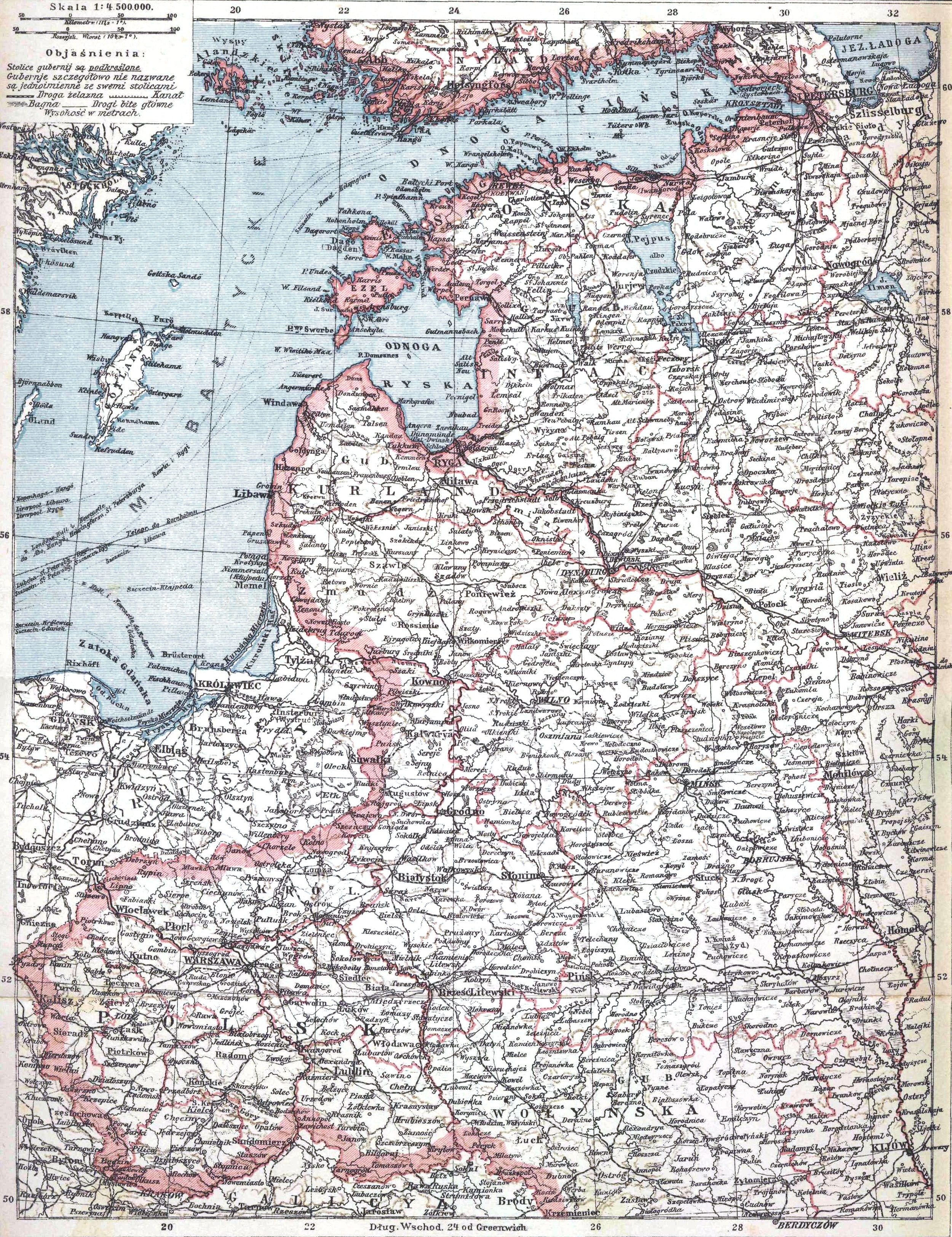
1901 Grodno Gubernia
1914-18 Harms-
worth's New Atlas:
"POLAND." Note
boundaries, of
Poland and
Lithuania. (AK)
worth's New Atlas:
"POLAND." Note
boundaries, of
Poland and
Lithuania. (AK)
World War I:
July 28, 1914 - November 11, 1918
July 28, 1914 - November 11, 1918
1905 Richard Andree -
Albert Scobel: "WEST-
RUSZLAND NÖRDLICHE
TEIL" at 1:2 000 000,
40 x 51 cm, Leipzig, from
"Andree's Allgemeiner
Handatlas..." From
www.davidRumsey.com
Albert Scobel: "WEST-
RUSZLAND NÖRDLICHE
TEIL" at 1:2 000 000,
40 x 51 cm, Leipzig, from
"Andree's Allgemeiner
Handatlas..." From
www.davidRumsey.com


1915 "Western
Russia, Poland
and the Russo-
German Fron-
tier," from
Collier's War
Maps, C.B.
Hammond, New
York (AK)
Russia, Poland
and the Russo-
German Fron-
tier," from
Collier's War
Maps, C.B.
Hammond, New
York (AK)


1918 "Беларуская
(тарашкевіца): Мапа
Беларускай Народнай
Рэспублікі (Russian: Карта
Белорусской Народной
Республики) (Map of the
territory claimed by the
Belarusian National Republic)
From wikimedia
(тарашкевіца): Мапа
Беларускай Народнай
Рэспублікі (Russian: Карта
Белорусской Народной
Республики) (Map of the
territory claimed by the
Belarusian National Republic)
From wikimedia
1907: J.M. Bazewicz:
(mapmaker/ publisher), from his
"Atlas geograficzny ilustrowany
Królestwa Polskiego" (Geograph-
ical Illustrated Atlas of the Polish
Kingdom), Warsaw. Also
individual maps of Suwałki
guberniya administrative
districts, or powiats. From the
National Library of Poland, via www.
mapywig.org unless from my (AK)
collection: pages 82, 84, 85
| Page 79 Suwalski p. |
| Page 80 Augustowski p. |
| Pge 81 Kalwaryjski p. |
| Page 83 Sejneński p. |
| Page 84 Wladyslawowski p. |
| Page 82 Maryampolski p. |
| Page 85 Wylkowyski p. |


1915: "Germany's
demands in 1915 (As
circulated through the
Neutral Press)." From
http://images.
nationmaster.com/images/
motw/historical/british_
dominions_yearbook/ger_
demands_1915.jpg
demands in 1915 (As
circulated through the
Neutral Press)." From
http://images.
nationmaster.com/images/
motw/historical/british_
dominions_yearbook/ger_
demands_1915.jpg

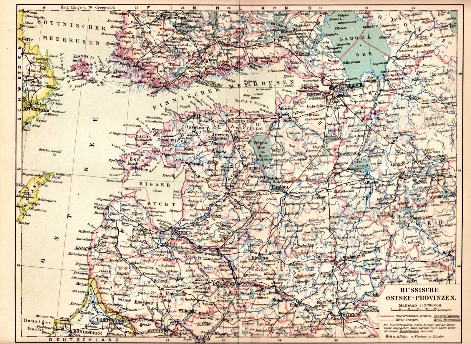
1905 Bibliograph-
isches Institut Leip-
zig: "RUSSISCHE
OSTSEE-PROVIN-
ZEN LIVLAND,
ESTHLAND, KUR-
LAND," at 1:2
250 000, from
"Meyers grosses
Konversations-
Lexicon," published
1885-1907. From
books_eldorado on eBay
isches Institut Leip-
zig: "RUSSISCHE
OSTSEE-PROVIN-
ZEN LIVLAND,
ESTHLAND, KUR-
LAND," at 1:2
250 000, from
"Meyers grosses
Konversations-
Lexicon," published
1885-1907. From
books_eldorado on eBay


1902: "RUSSIA, WESTERN
AND SOUTHERN PART,"
New York, map 10.5 x 15
inches, from the "Century
Atlas of the World." Also a
DETAIL image. From Lake
Erie Antique Maps and Prints on
eBay
AND SOUTHERN PART,"
New York, map 10.5 x 15
inches, from the "Century
Atlas of the World." Also a
DETAIL image. From Lake
Erie Antique Maps and Prints on
eBay


1915 "Russische
Festungen" (Russian
Forts), published just
months after the
beginning of WWI, and
just as the German army
began invading Russia.
This map appears
designed to guide
invasion strategy. From
www.mapywig.org
Festungen" (Russian
Forts), published just
months after the
beginning of WWI, and
just as the German army
began invading Russia.
This map appears
designed to guide
invasion strategy. From
www.mapywig.org

1910, July Brockhaus:
"MILITÄR DISLOKATION
IM DEUTSCHEN REICHE,
ÖSTLICHE GRENZE"
(Military locations in the
German Reich, eastern
border) (530KB), Leipzig,
at 1:4 450 000, from the
Brockhaus "Konversa-
tions - Lexikon." From heske
on eBay
"MILITÄR DISLOKATION
IM DEUTSCHEN REICHE,
ÖSTLICHE GRENZE"
(Military locations in the
German Reich, eastern
border) (530KB), Leipzig,
at 1:4 450 000, from the
Brockhaus "Konversa-
tions - Lexikon." From heske
on eBay

1915 "Sekt. III
WILNO BRZESC
LITEWSKI MINSK,"
from a Polish atlas.
WILNO BRZESC
LITEWSKI MINSK,"
from a Polish atlas.

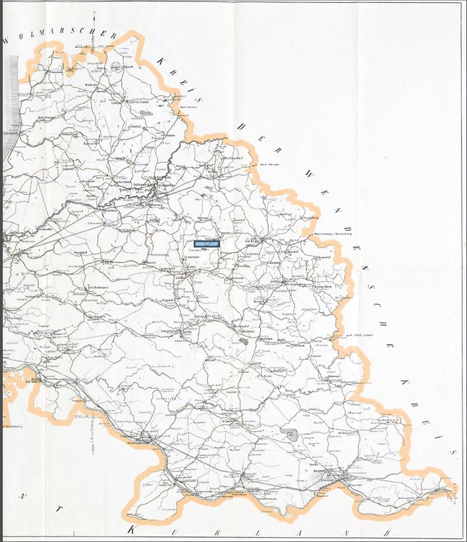
1902 "Wegekarte des Riga-
schen Kreises" (Route Map,
Riga District),at 1:210 000, a
folding map published by the
Liv-Estlandischen Landes-
kulturbureau. From DSPACE at
the Univ. of Tartu, Estonia:
http://dspace.utlib.ee/dspace/
schen Kreises" (Route Map,
Riga District),at 1:210 000, a
folding map published by the
Liv-Estlandischen Landes-
kulturbureau. From DSPACE at
the Univ. of Tartu, Estonia:
http://dspace.utlib.ee/dspace/

1909 Bibliographisches
Institut, Leipzig: "WEST-
RUSSLAND," 10 5/8 x 8
1/4 inches. From
antiquemapsprints on eBay
Institut, Leipzig: "WEST-
RUSSLAND," 10 5/8 x 8
1/4 inches. From
antiquemapsprints on eBay


| 1911 www.karty.by |
1911 and 1916 Benedykt Hertz: "Mapa szseciu gubernji
Litwy i Bialej Rusi." (Map of the six guberniyas of
Lithuania and White Russia) by the publishing house
"Kurjera Litewskiego," Edmund Nowiekiego, editor. The
1911 version is sections of paper glued to linen; the
1916 version is paper, only.
Litwy i Bialej Rusi." (Map of the six guberniyas of
Lithuania and White Russia) by the publishing house
"Kurjera Litewskiego," Edmund Nowiekiego, editor. The
1911 version is sections of paper glued to linen; the
1916 version is paper, only.
c. 1919 '"Mapa ziem polskich" (Map
of Polish Lands), published in Lwów
and Warszawa by Nakład Księgarni
Polskiej Bernarda Połonieckiego
(Polish bookshop run by Bernard
Połonieckiego). Printed area 77 x 68
cm. Published in at least three
editions, the tird dated 1920. A
gretly reduced depiction of the
Polish state. From www.mapywig.org

1915 G. Peltier: "Les
Provinces Baltiques De La
Russie," in four sheets.
From www.angelfire. com/ms2
/belaroots/Baltic_home.htm
Provinces Baltiques De La
Russie," in four sheets.
From www.angelfire. com/ms2
/belaroots/Baltic_home.htm


1908 Leonid Arbusow:
"Geschichte Liv-, Est-
und Kurlands," Riga,
34 x 42 cm, from his
"Grundriss der
Geschichte Liv-, Est-
und Kurlands" (History
of Livonia, Estonia and
Courland).From
books_eldorado on eBay
"Geschichte Liv-, Est-
und Kurlands," Riga,
34 x 42 cm, from his
"Grundriss der
Geschichte Liv-, Est-
und Kurlands" (History
of Livonia, Estonia and
Courland).From
books_eldorado on eBay


1916 Eugeniusz Romer:
"Administracya"
(Administrative districts
of Poland), Vienna, at
1:5 000 000, map
number 6 from his
"Geograficszno-
statystyczny atlas
Polski. "This map
is notable for its
characterization, via
pink coloring, of
"Litauen" and "Klein-
Russland" -- a Russian
term for Ukraine -- as
one entity. From
www.mapywig.org
1917 Eugeniusz Romer:
"Wojenno-politczna
mapa Polski" (A military-
political map of Poland
[on the occasion of the
Proclamation of 5th
November 1916]).
Germany and Austria-
Hungary issued a
manifesto promising
freedom and statehood
to a Polish nation.
Romer's "sfera polskich
interesow" (sphere of
Polish interests) include
nearly all of the former
Grand Duchy of
Lithuania's lands. From
www.mapywig.org

1919 Luit. Mantnieks: "Latvijas
Karte. Carte de la Latvie," 21.7 x
19.9 inches. One of the earliest
maps showing an independent
Latvia. From www.swaen.com
Karte. Carte de la Latvie," 21.7 x
19.9 inches. One of the earliest
maps showing an independent
Latvia. From www.swaen.com

1916 Józef Micha łBazewicz: "
Mapa Europy Środkowej" (Map
of Central Europe), Warsaw,
68.5 x 50.0 cm. From www.
polona.pl
Mapa Europy Środkowej" (Map
of Central Europe), Warsaw,
68.5 x 50.0 cm. From www.
polona.pl

1919 "Map of Lithuanain
Republic," a proposed map of a
newly independent Lithuania said
to have been delivered to the Paris
Peace Conference by the
Lithuanian delegation. In 1939,
Lithuanian Foreign Minister
Stasys Lozoraitis proposed the
same map and boundaries to
German Foreign Minister
Ribbentrop as part of Polish
partition discussions. From
www.forum.paradoxplaza.com

1915 "Sonderkarte 4 Kriege
der Karte zum gegen Ruß-
land - Kurland und Liv-
land" (Special Map No. 4 on
the map for the war against
Russia - Courland and
Livonia), with detail maps
of the the areas of
"Warschau" and "Brest-
Litovsk". From mapywig.org
der Karte zum gegen Ruß-
land - Kurland und Liv-
land" (Special Map No. 4 on
the map for the war against
Russia - Courland and
Livonia), with detail maps
of the the areas of
"Warschau" and "Brest-
Litovsk". From mapywig.org

1918 "The Proposed Frontiers of
Poland," a hand-drawn map,
Appendix No .4 to Roman
Dmowski's memo submitted to
President Woodrow Wilson on 8th
Oct 1918. From the Library of Congress
via mapywig
Poland," a hand-drawn map,
Appendix No .4 to Roman
Dmowski's memo submitted to
President Woodrow Wilson on 8th
Oct 1918. From the Library of Congress
via mapywig

1910 K.A. Raag'l: "EESTI-
LIIWIJA KURAMAA,"
Tartu, with Estonian
notations in the Cyrillic
and Latin alphabet. From
Univ. of Tartu, Estonia:
http://dspace.utlib.ee/dspace
LIIWIJA KURAMAA,"
Tartu, with Estonian
notations in the Cyrillic
and Latin alphabet. From
Univ. of Tartu, Estonia:
http://dspace.utlib.ee/dspace
1911 Józef Michał
Bazewicz : "Mapa
Litwy i Rusi," War-
saw, showing Russ-
ian gubernii, labels
in Polish. The Wroblew-
ski Library of the Lithu-
anian Academy of
Sciences: elibrary.mab.lt/
Bazewicz : "Mapa
Litwy i Rusi," War-
saw, showing Russ-
ian gubernii, labels
in Polish. The Wroblew-
ski Library of the Lithu-
anian Academy of
Sciences: elibrary.mab.lt/
1902 "Gubernie
zachodnie krolest-
wo polskie," from
"Orgelbrand's
Universal Encyc-
lopedia," Warsaw,
1898-1904, 16
volumes. From
wikicommons
zachodnie krolest-
wo polskie," from
"Orgelbrand's
Universal Encyc-
lopedia," Warsaw,
1898-1904, 16
volumes. From
wikicommons

1910 Dr. v. H.
Schwarz: "Karte der
Kurischen Nehrung"
(Curonian Spit, or
Neringa), Königsberg,
as a folding map. From
The Wroblewski Library of
the Lithuanian Academy of
Sciences: elibrary.mab.lt
Schwarz: "Karte der
Kurischen Nehrung"
(Curonian Spit, or
Neringa), Königsberg,
as a folding map. From
The Wroblewski Library of
the Lithuanian Academy of
Sciences: elibrary.mab.lt

1907 "КАРТА
КОВЕНСКОЙ
ГУБЕРНIИ" ((Map,
Kovno guberniya). From
US Library of Congress via
www.mapywig.org
КОВЕНСКОЙ
ГУБЕРНIИ" ((Map,
Kovno guberniya). From
US Library of Congress via
www.mapywig.org

1918 "Oberbefehls-
haber Ost (General
beim Stabe) Zen-
tralpolizeistelle
Litauen – Kur-
land." Bounda-
ries through
August 1917.
From The Wrob-
lewski Library of the
Lithuanian Academy
of Sciences: elibrary.
mab.lt/
haber Ost (General
beim Stabe) Zen-
tralpolizeistelle
Litauen – Kur-
land." Bounda-
ries through
August 1917.
From The Wrob-
lewski Library of the
Lithuanian Academy
of Sciences: elibrary.
mab.lt/
1908 "Russische Ostsee-
Provinzen," from the 6th
edition of "Meyers Großes
Konversations-Lexikon,
published 1902-08. From
rus.starina on eBay
Provinzen," from the 6th
edition of "Meyers Großes
Konversations-Lexikon,
published 1902-08. From
rus.starina on eBay
1914 "Karte
vom Östlichen
Kriegsschau-
platz"(Map of
Eastern Battle
sites) -- a post-
card map. From
lim_yap on eBay
vom Östlichen
Kriegsschau-
platz"(Map of
Eastern Battle
sites) -- a post-
card map. From
lim_yap on eBay

1915 "КОВЕНСКАЯ
губерния," Petrograd,
32 x 22.5 cm. From
6440tat on eBay
губерния," Petrograd,
32 x 22.5 cm. From
6440tat on eBay

1915 Alexander Gross (mapmaker) -
Geographia Ltd. (publisher): "The Daily
Telegraph War Map No. 17," London, 71 x
97 cm. From the Norman B. Leventhal Map Center
at the Boston Public Library: www.leventhalmap.org
Geographia Ltd. (publisher): "The Daily
Telegraph War Map No. 17," London, 71 x
97 cm. From the Norman B. Leventhal Map Center
at the Boston Public Library: www.leventhalmap.org


1914 "Dr. Henry Lange's [carto-
grapher] Karte von Liv-, Est- and
Kurland," Riga, in four images
published by Verlag von Kymmel.
Lange was a founder of the
Geographical Society in Leipzig.
From Univ. of Tartu, Estonia, at dspace:
http://dspace.ut.ee
grapher] Karte von Liv-, Est- and
Kurland," Riga, in four images
published by Verlag von Kymmel.
Lange was a founder of the
Geographical Society in Leipzig.
From Univ. of Tartu, Estonia, at dspace:
http://dspace.ut.ee
1918 Stanisław Max (cartographer): "Mapa
Polski i krajów ościennych - Wydanie
Trzecie" (Map of Poland and Neighboring
Countries - 3rd Edition), Warsaw, 97 x 100
cm / 38.2 x 39.4 inch wall map, with
tentative boundaries and shading in green
crayon of the Second Polish Republic. From
Antiquariat Daša Pahor http://www.pahor.de
Polski i krajów ościennych - Wydanie
Trzecie" (Map of Poland and Neighboring
Countries - 3rd Edition), Warsaw, 97 x 100
cm / 38.2 x 39.4 inch wall map, with
tentative boundaries and shading in green
crayon of the Second Polish Republic. From
Antiquariat Daša Pahor http://www.pahor.de

1919 H. Laakmann
(publisher): "Latwijas
karte," at 1:650 000.
Depicts Palanga as within
Latvia's borders. Also
claimed by Lithuania, it
was finally assigned to
Lithuania as part of a
boundary treaty signed in
Riga May 14, 1921. Also,
the easternmost part of the
map goes only as far as
Rēzekne: Latgale was not
formally part of Latvia
until the 1920 treaty with
Soviet Russia. From the
National Library of Estonia http:
//www.digar.ee

1919 "Eroberung Kurlands im
Marz 1919" (Conquest of
Kurland, March 1919), Leipzig.
After the end of WWI, Rüdiger
Graf von der Goltz commanded
the army of the Baltic
German-established
Government of Latvia, which,
in 1919, was instrumental in
the defeat of the Bolsheviks and
their local allies. His subsequent
defeat by Estonians under Ernst
Põdder ended hopes of German
control over the Baltic region.
The map shows front lines. From
lettsell on eBay
| 1916 wikimedia |
1920 Harmsworth
Atlas: "Baltic
Provinces," London,
8.5 x 12.5 inches,
1:4 000 000, with
tentative borders
for Lithuania. (AK)
Atlas: "Baltic
Provinces," London,
8.5 x 12.5 inches,
1:4 000 000, with
tentative borders
for Lithuania. (AK)
1920 "KARTE VON
LITAUEN." (AK)
LITAUEN." (AK)
1920 London Geographical
Institute: "Poland and the New
Baltic States," from "The
Peoples Atlas," by George
Philip & Son, with tentative
borders before May 1921's
Peace of Riga. Placenames are
pre-1914 transcripted
Russian. From www.hipkiss.org
CAUTION: when you try to go
to this site, it may attack your
computer or smartphone!
1920 "The
Republic of
Lithuania." From
The Times (of London)
Republic of
Lithuania." From
The Times (of London)
1920 "MAPA SIECI
KOLEI ZELAZNYCH
PANSTWA POLSKIEGO"
("Your Polish Railways")
by type of track. From
www.mapywig.org
KOLEI ZELAZNYCH
PANSTWA POLSKIEGO"
("Your Polish Railways")
by type of track. From
www.mapywig.org
1920 Edward Wacław Maliszewski
(historian/mapmaker) - Instytut
Gospodarstwa Społecznego (publisher):
"WSCHODNIE GRANICE POLSKI"
(Poland's Eastern Frontiers), Warsaw,
26.5 x 24.5 inches. From www.mapywig.org
(historian/mapmaker) - Instytut
Gospodarstwa Społecznego (publisher):
"WSCHODNIE GRANICE POLSKI"
(Poland's Eastern Frontiers), Warsaw,
26.5 x 24.5 inches. From www.mapywig.org


1920 "POLAND,
LITHUANIA, LATVIA,
ESTHONIA. " George F.
Cram Co., Chicago.
LITHUANIA, LATVIA,
ESTHONIA. " George F.
Cram Co., Chicago.
1920 Henryk
Arctowski (mapmaker) -
General Drafting Co.,
Inc. (publisher):
"Poland," New York,
showing treaty
boundaries as of 1920.
From Norman B.
Leventhal Map Center at the
Boston Public Library:
www.leventhalmap.org
Arctowski (mapmaker) -
General Drafting Co.,
Inc. (publisher):
"Poland," New York,
showing treaty
boundaries as of 1920.
From Norman B.
Leventhal Map Center at the
Boston Public Library:
www.leventhalmap.org
1920 "POLAND,"
from "Victory Atlas
of the World," with
unusual boundaries
for post-war Poland.
from "Victory Atlas
of the World," with
unusual boundaries
for post-war Poland.


1920 "Rand McNally
Standard Map of
POLAND," showing
boundaries and
plebiscite areas. From
plaindealing on eBay
Standard Map of
POLAND," showing
boundaries and
plebiscite areas. From
plaindealing on eBay

"1920 Supplementary
Adjustments to the 1920
Treaty between Russia and
Lithuania." Poland, in this
Cyrillic treaty map, is
nowhere to be seen.
Adjustments to the 1920
Treaty between Russia and
Lithuania." Poland, in this
Cyrillic treaty map, is
nowhere to be seen.
c. 1920 "Carte des Lignes
de Démarcation Conséc-
utives en Lithuanie...
Violées par les Polonais."
From The Wroblewski Library
of the Lithuanian Academy of
Sciences: elibrary.mab.lt/
de Démarcation Conséc-
utives en Lithuanie...
Violées par les Polonais."
From The Wroblewski Library
of the Lithuanian Academy of
Sciences: elibrary.mab.lt/
1921 "Baltischer Lander,"
probably from from
"Steiler's Handatllas." From
montrealmaps.com
probably from from
"Steiler's Handatllas." From
montrealmaps.com


1921 Funk &
Wagnall's "Poland
and Lithuania,"
showing unsettled
boundaries. (AK)
Wagnall's "Poland
and Lithuania,"
showing unsettled
boundaries. (AK)
c. 1921 Alexander Gross: "New Map of
Poland," London, 23.5 x 18 inches. From
www.raremaps.com
Poland," London, 23.5 x 18 inches. From
www.raremaps.com


1921 "Poland Railways," from the "Polish
Almanac," Institute of Social Economy,
Warsaw. Also, DETAIL images from other
maps in the almanac. (AK)
Almanac," Institute of Social Economy,
Warsaw. Also, DETAIL images from other
maps in the almanac. (AK)
1921 J. Rozes: "LATVIJAS KARTE, ar
dalu no Pleskavas un Kaunas
gubernam," Riga. From www.mapywig.org
dalu no Pleskavas un Kaunas
gubernam," Riga. From www.mapywig.org
1921 Wykonane w Insytucie wojs. geogr.
we Wiedniu: "Wielka Mapa Rzeczpospolitej
Polskiej." Borders shown include: “Polish
ethnographic area,” "line of Bolshevik-
Lithuanian treaty,"Żeligowski front-
line,” "Foch line,” and "borders of Polish
administrative control.” From http://english.
mapywig.org/viewpage.php?page_id=37
we Wiedniu: "Wielka Mapa Rzeczpospolitej
Polskiej." Borders shown include: “Polish
ethnographic area,” "line of Bolshevik-
Lithuanian treaty,"Żeligowski front-
line,” "Foch line,” and "borders of Polish
administrative control.” From http://english.
mapywig.org/viewpage.php?page_id=37
1921 Bibliographisches Institut
Leipzig: "POLEN," 9.4 x 11.8
inches. From hansaword on eBay
Leipzig: "POLEN," 9.4 x 11.8
inches. From hansaword on eBay
| 1921 www.RCIN.org |
Józef Michał Bazewicz: "Mapa Polski w granicach obec nych podziałem" (Map of
Poland with its current borders) Warsaw, in 1921 and 1922 iterations, showing
how the border with Poland changed, with two DETAIL images.
Poland with its current borders) Warsaw, in 1921 and 1922 iterations, showing
how the border with Poland changed, with two DETAIL images.
| 1922 Kujawsko-Pomorska Biblioteka Cyfrowa |


| Minerals |

| Corn, Wheat, Rye |


Created 1915, published after the Paris Peace Conference of 1919: Compiled at the Royal
Geographical Society under the direction of the Geographical Section, General Staff, drawn and printed
by the Ordnance Survey. In preparation for the peace conference that was expected to follow World War I,
in the spring of 1917 the British Foreign Office established a special section responsible for preparing
background information for use by British delegates to the conference. "Maps of Poland," in which the
above two maps appeared, is Number 49 in a series of studies produced by the section. The book contains
eight foldout maps, six from the General Map of Europe: regions around six major cities in or near what
would become the newly independent Polish Republic: Berlin, Warsaw, Minsk, Vienna, Krakau (Krakow),
and Jitomir (Zhytomyr, Ukraine). Also included: “Ethnographical Map of Central and South Eastern
Europe,” “Partitions of Poland,” both on this site. Images: Daniel Crouch Rare Books: crouchrarebooks.com
| "(WARSAW) VARSHAVA " |
| "MINSK" |

1919 Merton M. Wilner:
"Poland," from "A New Atlas
of the New World Corrected
According to the Peace
Terms..," The Christian
Herald, New York. From the
private collection of Roy
Winkelman via
http://etc.usf.edu/maps
"Poland," from "A New Atlas
of the New World Corrected
According to the Peace
Terms..," The Christian
Herald, New York. From the
private collection of Roy
Winkelman via
http://etc.usf.edu/maps

1903 F.A. Brock-
haus: (WESTRUSS-
LAND UND OST-
SEEPROVINZEN,"
Leipzig, from "Kon-
versations Lexikon."
Compare with 1897
version. From ldd
shipping on eBay.de
haus: (WESTRUSS-
LAND UND OST-
SEEPROVINZEN,"
Leipzig, from "Kon-
versations Lexikon."
Compare with 1897
version. From ldd
shipping on eBay.de


1904 Saturnin Józef
Sikorski: "Mapa
guberni Królestwa
Polskiego," Warsaw,
28 x 22 cm. From
www.polona.pl via
www.RCIN.org
Sikorski: "Mapa
guberni Królestwa
Polskiego," Warsaw,
28 x 22 cm. From
www.polona.pl via
www.RCIN.org

1914 Carl Flemming
(publisher): "Karte
von West-Kurland,
Litauen und Ost-
preußen, No. 25"
Berlin, from
"Flemmings Kriegs-
karten." From Staats-
bibliothek zu Berlin via
wikimedia
(publisher): "Karte
von West-Kurland,
Litauen und Ost-
preußen, No. 25"
Berlin, from
"Flemmings Kriegs-
karten." From Staats-
bibliothek zu Berlin via
wikimedia


1916 Carl Flemming
(publisher): "Russischen
Ostzeeprovinzen," Berlin,
depicting forts in Russian
cities. From Staatsbibliothek zu
Berlin via wikimedia
(publisher): "Russischen
Ostzeeprovinzen," Berlin,
depicting forts in Russian
cities. From Staatsbibliothek zu
Berlin via wikimedia

1917 Carl Flem-
ming (publisher):
"Das Russische
Kriegsgebiet, Nr.
17" Berlin, depict-
ing the Russian
front. From Staats-
bibliothek zu Berlin
via wikimedia
ming (publisher):
"Das Russische
Kriegsgebiet, Nr.
17" Berlin, depict-
ing the Russian
front. From Staats-
bibliothek zu Berlin
via wikimedia


1915 Carl Flemming (publish-
er): "WESTRUSSLAND," Berlin
and Glogau. From Staatsbibliothek
zu Berlin via wikimedia
er): "WESTRUSSLAND," Berlin
and Glogau. From Staatsbibliothek
zu Berlin via wikimedia
1914 Carl Flemming
(publisher): "West-
liches Russland.,"
Berlin, part of the
series "Flemmings
Kriegskarten."
See highlighted forts:
"Kovno," Grodno," etc.
From Staatsbibliothek zu
Berlin via wikimedia
(publisher): "West-
liches Russland.,"
Berlin, part of the
series "Flemmings
Kriegskarten."
See highlighted forts:
"Kovno," Grodno," etc.
From Staatsbibliothek zu
Berlin via wikimedia

1912 Leon Wasi-
lewski (historian/
politician):
"Granice Litwy"
(Borders of
Lithuania), from
"Litwa i Białoruś."
lewski (historian/
politician):
"Granice Litwy"
(Borders of
Lithuania), from
"Litwa i Białoruś."

c. 1904 "ROSSYA POLUDNIOWO -
ZACHODNIA" (SOUTH-WEST
RUSSIA), from "WIELKI ATLAS
GEOGRAFICZNY ZE
SKOROWIDZEM NAZW I
TEKSTEM OBJAŚNIAJĄCYM..."
(Great Geographic Atlas with
Gazetteer and Explanatory
Text), edited by Wacław
Nałkowski and Andrzej
Świętochowski. No labels for
guberniyas, but labels for
"Żmudź," "Samogitia,"
"Kurlandya," and "Semigalia."
From Składnica Map Biblioteki W
ydziału Nauk o Ziemi Uniwersytetu
Śląskiego via www.mapywig.org

1919 Jan Zabiełło (mapmaker):
"Mapa Rzeczypospolitej Polskiej z
..," (Map of the Republic of Poland
with her western and north-
western frontiers as set forth in the
Treaty of Versailles with Germany
on 28 June 1919. The south-western
and eastern frontiers drawn as per
plans of the National Committee in
Paris.) From www.mapywig.org

c. 1915 Geograph-
ische Anstalt von
Velhagen & Klasing
(publisher): "Deutsch-
Russische Grenz-
lande," (German-
Russian Boundary
Lands), Leipzig,
Bielefeld.From
National Library of
Finland: www.doria.fi
ische Anstalt von
Velhagen & Klasing
(publisher): "Deutsch-
Russische Grenz-
lande," (German-
Russian Boundary
Lands), Leipzig,
Bielefeld.From
National Library of
Finland: www.doria.fi


1918 [dated] Wiktor Skarga-
Dobrowolski: "CUDZEGO NIE
CHCEMY, SWEGO NIE
ODDAMY! (We don't want
others' land, we won't give up
ours!). "MAPA ZJED-
NOCZONEJ POLSKI" (Map of
United Poland). From
https://eloblog.pl/
Dobrowolski: "CUDZEGO NIE
CHCEMY, SWEGO NIE
ODDAMY! (We don't want
others' land, we won't give up
ours!). "MAPA ZJED-
NOCZONEJ POLSKI" (Map of
United Poland). From
https://eloblog.pl/

c. 1921 Berliner Lithographisches Institut Julius Moser
(mapmaker): "Ausgedehnte Spezial-Verkehre nach und
von Polen und Russland, Überreicht durch Helmuth
Haenisch," Berlin. An advertising flyer by a logistics
firm, reducing part of the 1921 "GEA Map of Europe."
(mapmaker): "Ausgedehnte Spezial-Verkehre nach und
von Polen und Russland, Überreicht durch Helmuth
Haenisch," Berlin. An advertising flyer by a logistics
firm, reducing part of the 1921 "GEA Map of Europe."

| www.mapywig.org |
| Beinecke Rare Book and Map Library, Yale |

c. 1914 A. Taride (editor) -
Cartes Taride (publisher):
"PROVINCES BALTIQUES,"
Paris, dated via the label
"Petrograd," the re-name
for St. Petersburg in
1914, just before the
start of WWI, because its
original name sounded
too German. From the
Poznan State Archive, Poland,
via www.mapywig.org
Cartes Taride (publisher):
"PROVINCES BALTIQUES,"
Paris, dated via the label
"Petrograd," the re-name
for St. Petersburg in
1914, just before the
start of WWI, because its
original name sounded
too German. From the
Poznan State Archive, Poland,
via www.mapywig.org

c. 1914 Geograph. Anstalt von Velhagen & Klassing
(mapmaker/publisher): "Sonderkarte 3 [and 4] der
Karten zum Kriege gegen Rußland (Special Map 3 [and
4] on the War Against Russia): Leipzig, in two adjacent
maps from the series. Both maps from the Poznan State
Archive, Poland, via www.mapywig.org
(mapmaker/publisher): "Sonderkarte 3 [and 4] der
Karten zum Kriege gegen Rußland (Special Map 3 [and
4] on the War Against Russia): Leipzig, in two adjacent
maps from the series. Both maps from the Poznan State
Archive, Poland, via www.mapywig.org
1914 (on a 1910 Stielers
Handatlas plate) "Die
Befestigungen in
Russisch-Polen." (The
front lines in Russian-
Poland.) (AK)
Handatlas plate) "Die
Befestigungen in
Russisch-Polen." (The
front lines in Russian-
Poland.) (AK)

| "Ostpreußen und Litauen" |
| "Kurland, Livland und Estland" |

1921 [dated] Eugeniusz Romer
(cartographer) - KSIĄŻNICA POLSKA
(publisher): "POLSKA Mapa
hypsometryczna" (Map depicting elevation),
Lwów - Warszawa. From Archiwum Państwowe
w Poznaniu via www.mapywig.org
(cartographer) - KSIĄŻNICA POLSKA
(publisher): "POLSKA Mapa
hypsometryczna" (Map depicting elevation),
Lwów - Warszawa. From Archiwum Państwowe
w Poznaniu via www.mapywig.org


1920 [dated] R.
Ingarden (mapmaker):
"Rzeki i kanały żeglowne
w b. trzech zaborach"
(Navigable rivers and
canals in the former three
partitions [of Poland]).
From www.mapywig.org
Ingarden (mapmaker):
"Rzeki i kanały żeglowne
w b. trzech zaborach"
(Navigable rivers and
canals in the former three
partitions [of Poland]).
From www.mapywig.org

1915 Oskar Eulitz
Verlag (publisher):
"Kriegskarte West-
liches Russland und
angrenzende
mitteleuropäische
Gebiete," Lissa,
Germany (today's
Leszno, Poland).
depicting forts --
among those the forts
around "Kowno."
From Versandantiquariat
Höbald , Halle, Germany,
via zvab.com
Verlag (publisher):
"Kriegskarte West-
liches Russland und
angrenzende
mitteleuropäische
Gebiete," Lissa,
Germany (today's
Leszno, Poland).
depicting forts --
among those the forts
around "Kowno."
From Versandantiquariat
Höbald , Halle, Germany,
via zvab.com

1919 Herbert Heyde (geo-
grapher) - Gea Verlag (pub-
lisher): "Gea-Eisenbahn- karte
von Osteuropa," Berlin, 97 x 77
cm, depicting railway lines on a
map with boundaries "claimed
by Lithuania." From the Americam
Geographical Society Library at Univ.
of Wisconsin, Milwaukee, Libraries:
https://collections.lib.uwm.edu/
grapher) - Gea Verlag (pub-
lisher): "Gea-Eisenbahn- karte
von Osteuropa," Berlin, 97 x 77
cm, depicting railway lines on a
map with boundaries "claimed
by Lithuania." From the Americam
Geographical Society Library at Univ.
of Wisconsin, Milwaukee, Libraries:
https://collections.lib.uwm.edu/

1912 W.& A.K. Johnston
(engraver/printer/pub-
lisher): "South-West
Russia (with) Odessa.
Showing the Extent of
the Kingdom of Poland
prior to its partition in
1772," Edinburgh, Lon-
don, 47 x 58 cm, from
"Keith Johnston's
General Atlas." From
www.davidrumsey.com
(engraver/printer/pub-
lisher): "South-West
Russia (with) Odessa.
Showing the Extent of
the Kingdom of Poland
prior to its partition in
1772," Edinburgh, Lon-
don, 47 x 58 cm, from
"Keith Johnston's
General Atlas." From
www.davidrumsey.com

c. 1920 "Granice niezbedne Państwu
Polskiemu" (Borders necessary for the
Polish State). From www.karty.by
Polskiemu" (Borders necessary for the
Polish State). From www.karty.by

1921 Kenyon Co.
(mapmaker) -
Heald Co.
(publisher):
"Map of Western
Russia and the
Ukraine
Republic."
Ball State University
Digital Media
Repository: https://
dmr.bsu.edu/digital/
collection/
(mapmaker) -
Heald Co.
(publisher):
"Map of Western
Russia and the
Ukraine
Republic."
Ball State University
Digital Media
Repository: https://
dmr.bsu.edu/digital/
collection/

1920 [dated] Edward Wacław
Maliszewski (historian/map-
maker) - WYDAWNICTWO
INSTYTUTU GOSPODARSTWA
SPOłECZNEGO (publisher):
"WSCHODNIE GRANICE POLSKI"
(Poland's Eastern Frontiers),
Warsaw. From www.mapywig.org
Maliszewski (historian/map-
maker) - WYDAWNICTWO
INSTYTUTU GOSPODARSTWA
SPOłECZNEGO (publisher):
"WSCHODNIE GRANICE POLSKI"
(Poland's Eastern Frontiers),
Warsaw. From www.mapywig.org
1921 "Nowa Mapy Polski," New
York, 55 x 48 cm, depicting
presumed Polish and plebiscite
coundaries. From www.polona.pl
York, 55 x 48 cm, depicting
presumed Polish and plebiscite
coundaries. From www.polona.pl


1919 Service géographique de l'armée
(French Army Geographic Service) -
Eugeniusz Romer - Comité d'études (Study
Committee - publisher): "Répartition des
Grandes Propriétés Sur le Terretoire de la
Pologne Historique, d'apres Romer"
(Distribution of large properties in the area
of Historic Poland) Paris, from the study
committee's "Volume II. European issues,
Northern and Eastern Europe," no doubt
prepared for the politicians redrawing the
map of post-WWI Europe. The legend
shows different colors representing percent
of large properties, but, does not define
"large properties." From Bordeaux Montaigne
University: http://1886.u-bordeaux-montaigne.fr

c. 1918 Hijos de J. Espada (descendants of
J. Espasa, editors): "POLONIA," Madrid,
from "Enciclopedia Universal." DEpicts a
number of different boundaries for
"Polonia" and "Lituania." From Cartographic
and Geological Institute of Catalonia:
https://cartotecadigital.icgc.cat/digital/collection
J. Espasa, editors): "POLONIA," Madrid,
from "Enciclopedia Universal." DEpicts a
number of different boundaries for
"Polonia" and "Lituania." From Cartographic
and Geological Institute of Catalonia:
https://cartotecadigital.icgc.cat/digital/collection
1908 [dated] Carl
Gottlieb Rücker
(cartographer):
"General-Karte der
Russischen Ost-See
Provinzen Liv- Ehst-
und Kurland," Reval.
Rücker, who died in
1856, created his
last map, which this
map is based upon,
in 1846. From
https://bilder.
deutschefotothek.de
Gottlieb Rücker
(cartographer):
"General-Karte der
Russischen Ost-See
Provinzen Liv- Ehst-
und Kurland," Reval.
Rücker, who died in
1856, created his
last map, which this
map is based upon,
in 1846. From
https://bilder.
deutschefotothek.de


c. 1918 American Geographical
Society of New York (publisher):
"POLAND & LITHUANIA," New
York, 38 x 30 cm, depicting the
area as Russia, with guberniya
labels. From Boston Public Library:
https://collections.leventhalmap.org/
Society of New York (publisher):
"POLAND & LITHUANIA," New
York, 38 x 30 cm, depicting the
area as Russia, with guberniya
labels. From Boston Public Library:
https://collections.leventhalmap.org/

1919 "NEW POLAND, Compiled from
the latest and most authentic sources
by Rudolph A. Armbruester Fellow
American Geographical Society,
Geographical Expert Grosvenor
Library, Buffalo, N.Y." depicting, in
yellow, "Part of Russian Territory
proposed to be given to Poland on
account of predominating Polish
population," when even Eugeniusz
Romer's ethnographic maps showed
Poles in most of the area at 1% - 50%.
From Boston Public Library:
https://collections.leventhalmap.org/

c. 1918 Max Friederichsen
(geographer/mapmaker) - Verlag
von L. Friederichsen & Co.
(publisher): "Karte von Litauen -
Lietuvos Žemlapis," Hamburg,
depicting provisional boundaries,
including "Litauen Süd." From
Martynas Mažvydas National Library of
Lithuania: https://www.lnb.lt/en/
(geographer/mapmaker) - Verlag
von L. Friederichsen & Co.
(publisher): "Karte von Litauen -
Lietuvos Žemlapis," Hamburg,
depicting provisional boundaries,
including "Litauen Süd." From
Martynas Mažvydas National Library of
Lithuania: https://www.lnb.lt/en/

1914 Carl
Flemming
(publisher): "Der
Kriegsschauplatz
in Polen," Berlin.
From http://gauss.
suub.uni-bremen.de/
Flemming
(publisher): "Der
Kriegsschauplatz
in Polen," Berlin.
From http://gauss.
suub.uni-bremen.de/
1917: "Das Land
Ober Ost."
Occupied
Russian Empire
Territories,
before the
September
1918 German
offensive.
Ober Ost."
Occupied
Russian Empire
Territories,
before the
September
1918 German
offensive.

1921 [dated] W. Główczewski (cartographer) - Graphical
Dept. P.A.K.P.D. (publisher): "A.R.A.E.C.F. POLAND P.A.K.P.
D.," Warsaw. ARA (American Relief Administration) was a
relief mission to Europe and later post-revolutionary Russia
formed, with a budget of a billion and a half dollars in
today's money, by the U.S. Congress in February 1919,
with future president Herbert Hoover as its director. It
delivered more than four million tons of relief supplies to 23
war-torn European countries. 20% of its resources were
directed to the "Second Polish Republic," much of that going
Polish children. In March 1919, the private ERC (European
Children's Fund) was founded to manage grants to children,
with Hoover as its chairman. In January 1920, the Polish
committee, headed by the wife of Paderewski, formed to
advise American relief efforts was renamed the Polish-
American Children’s Relief Committee (Polsko-
Amerykanski Komitet Pomocy Dzieciom) or PAKPD - Poles
asked to include “Amerykanski” in the name because the
name commanded truth and respect. This map depicts
warehouses and child feeding locations within Poland.
From the National Library of Poland via www.mapywig.org
| Page 1: "MAPA OGOLNA..." |


