Maps: 1919 - 1930


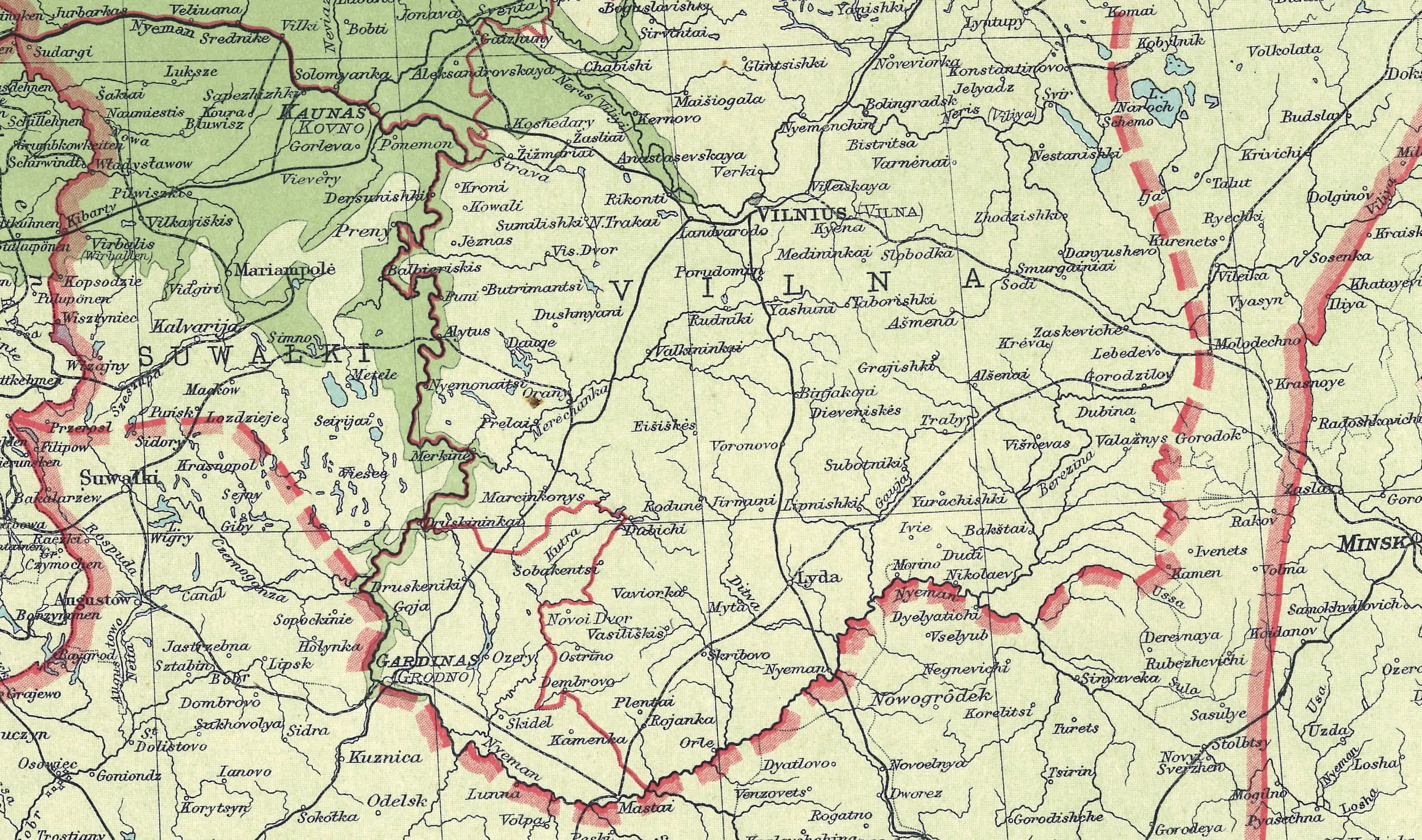
1920 "POLAND AND
THE NEW BALTIC
STATES," from "The
Peoples Atlas,"
showing the still-
undefined borders after the treaties of Brest-Litovsk and
Versailles, but before the May 1921 Peace of Riga. Most
place-names are pre-1914 transcripted Russian names, not local
names. Also a DETAIL image. From the London Geographical Institute

1920 "KARTE VON
LITAUEN." (AK)
LITAUEN." (AK)
Mapmakers try to keep up with what they think
are Lithuania's boundaries, as Poland hopes for a
reunited Polish-Lithuanian Commonwealth
are Lithuania's boundaries, as Poland hopes for a
reunited Polish-Lithuanian Commonwealth
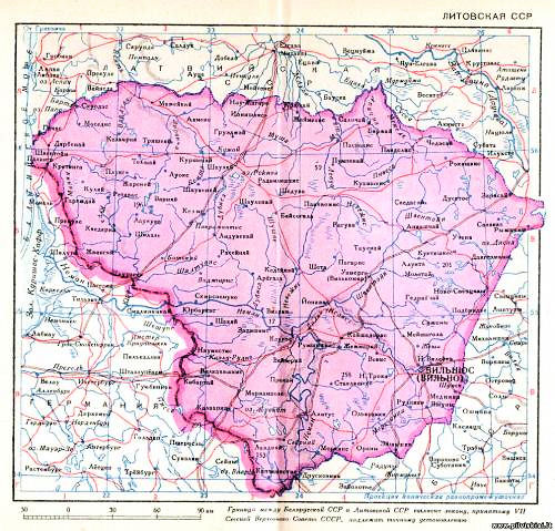
1920 "Litovskaya SSR."
Jumping the gun a little
bit, those Soviets.
Jumping the gun a little
bit, those Soviets.

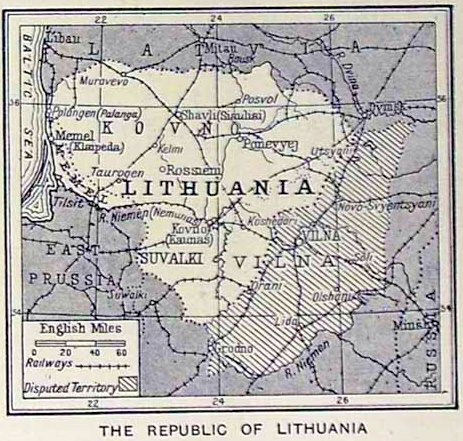
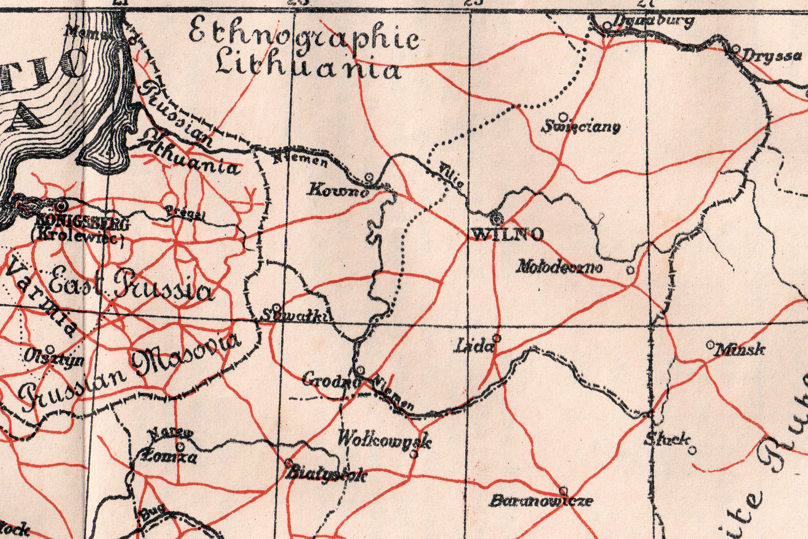
1920 "THE REPUBLIC OF LITHUANIA," from
The Times (of London), from a series called
"People of All Nations, their life story today and
the story of their past," edited by J A
Hammerton. Also a DETAIL image.
The Times (of London), from a series called
"People of All Nations, their life story today and
the story of their past," edited by J A
Hammerton. Also a DETAIL image.


| 1920 "NOWA EUROPA W ROKU 1919," Krakow- Warszawa. Also two DETAIL images. (AK) |

1921 "Poland Railways,"
from the "Polish
Almanac," Institute of Social Economy, Warsaw. Also, DETAIL images
focusing on Lithuania, along with legends. (AK)
from the "Polish
Almanac," Institute of Social Economy, Warsaw. Also, DETAIL images
focusing on Lithuania, along with legends. (AK)

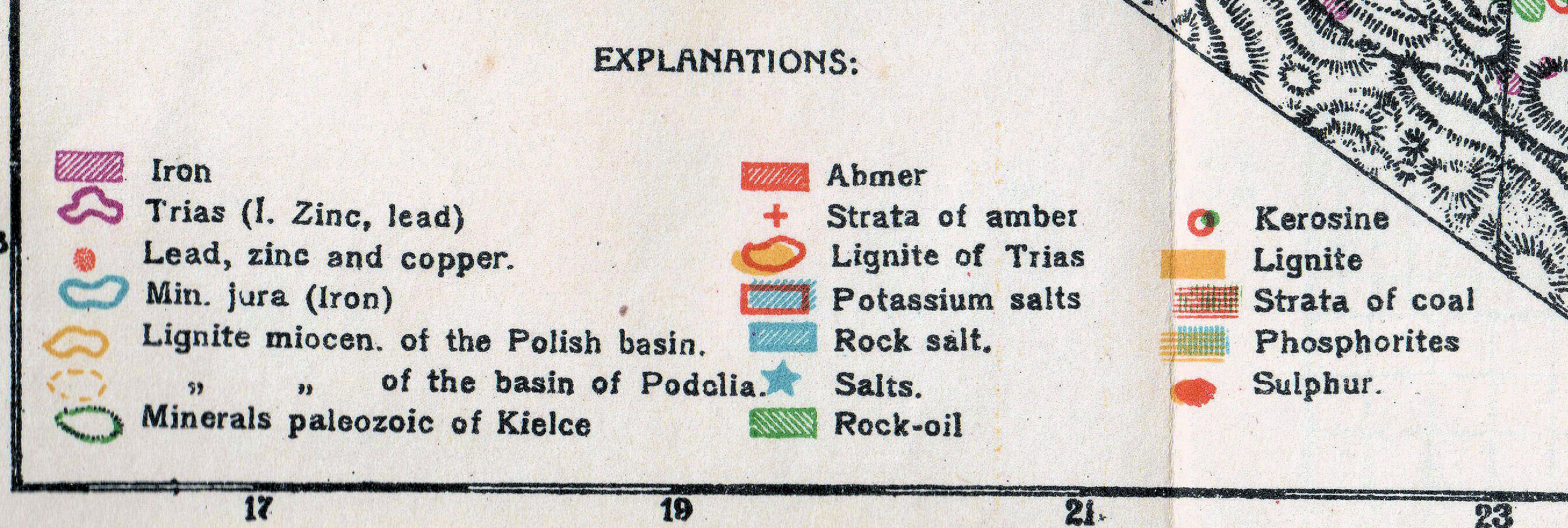
1921 "Mineral Production."


1921 "Corn, Wheat and Rye Production."

1921 Riga Treaty Boundaries. Lithuania
never accepted the loss of Vilnius, its historic
A glance at any of the historic maps on the
preceding pages will make clear that Vilnius
and the area surrounding it was never
considered part of the Kingdom of Poland.
never accepted the loss of Vilnius, its historic
A glance at any of the historic maps on the
preceding pages will make clear that Vilnius
and the area surrounding it was never
considered part of the Kingdom of Poland.

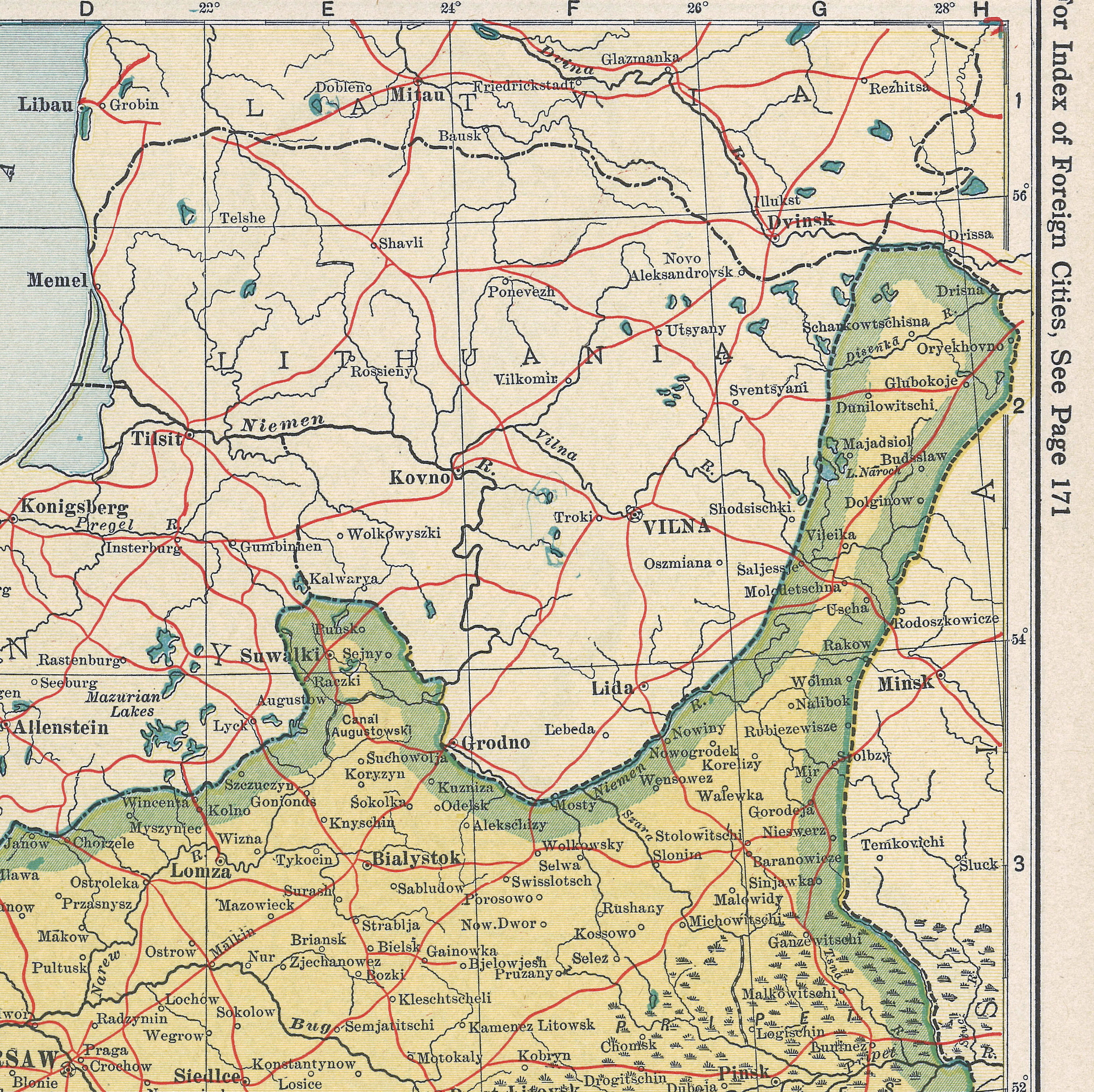
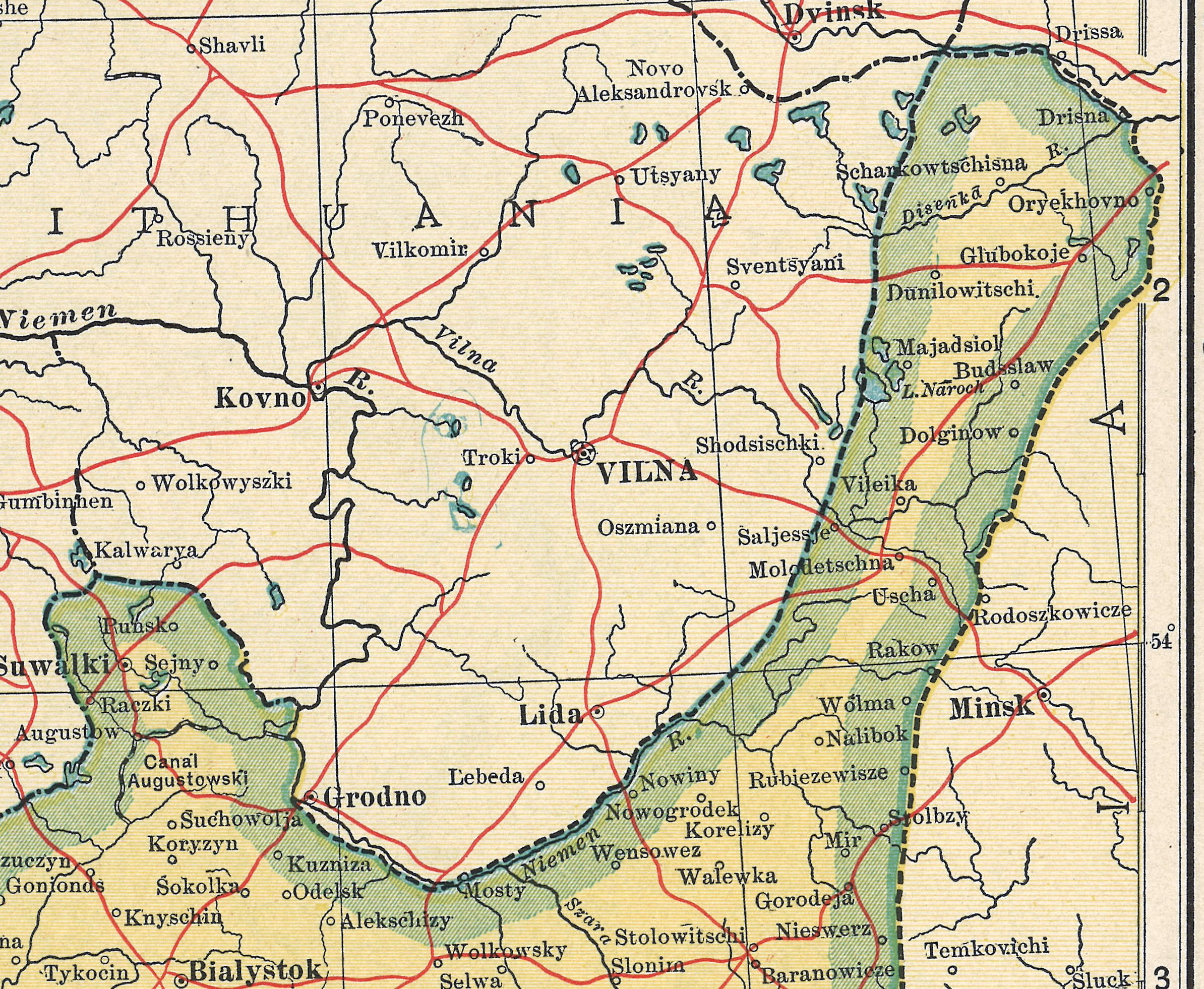
1921 "EASTERN EUROPE - COMMUNICATIONS," (the top half) from "The Times
Survey Atlas of the World," London. Also a DETAIL image. (AK)
Survey Atlas of the World," London. Also a DETAIL image. (AK)


1920 "POLAND,
LITHUANIA, LATVIA,
ESTHONIA. " George F.
Cram Co., Chicago.
LITHUANIA, LATVIA,
ESTHONIA. " George F.
Cram Co., Chicago.

1922 IWG: "RZECZPOSPOLITA POLSKA I KRAJE OSCIENNE," Also two DETAIL images.
1922 "Baltic States & East Prussia," (bottom half) from "The Times Atlas,"
London. Also four DETAIL images. (AK)
London. Also four DETAIL images. (AK)


1922 "POLAND." From
a U.S. atlas. Also two
DETAIL images. (AK)
a U.S. atlas. Also two
DETAIL images. (AK)
1923 Hammond Atlas: "The Baltic States. ESTHONIA, LATVIA and
LITHUANIA." Also a DETAIL image. Grodno and Lida are in
Lithuania, and many town names are the Yiddish versions. (AK)
LITHUANIA." Also a DETAIL image. Grodno and Lida are in
Lithuania, and many town names are the Yiddish versions. (AK)

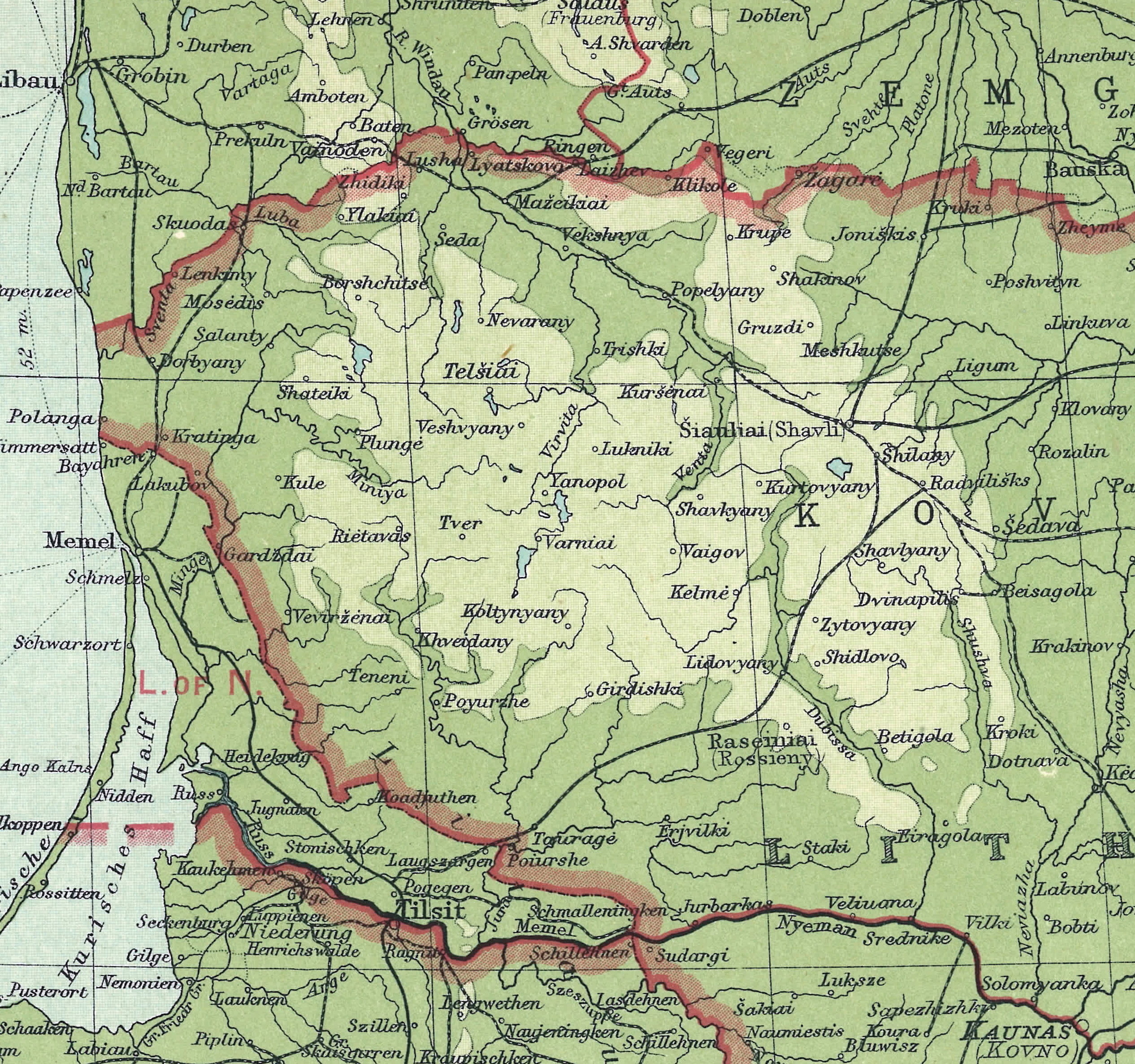
1927-28 "Dunlop Automobil Strassenkarte von Deutschland," sourced from Ravenstein Atlas plates. Each plate also has a DETAIL image. From www.kartenmeister.com
1927-28 "Tilsit. 1"
(Including
Memel/Klaipeda.)
(Including
Memel/Klaipeda.)


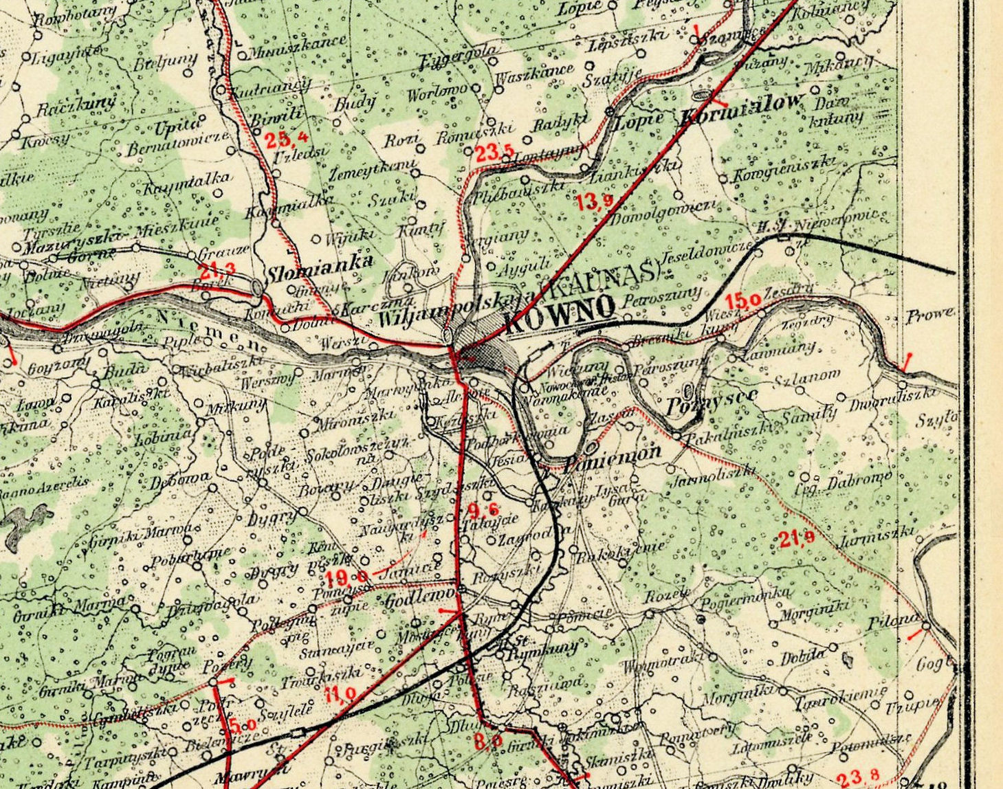
1927-28 "Kowno 2."

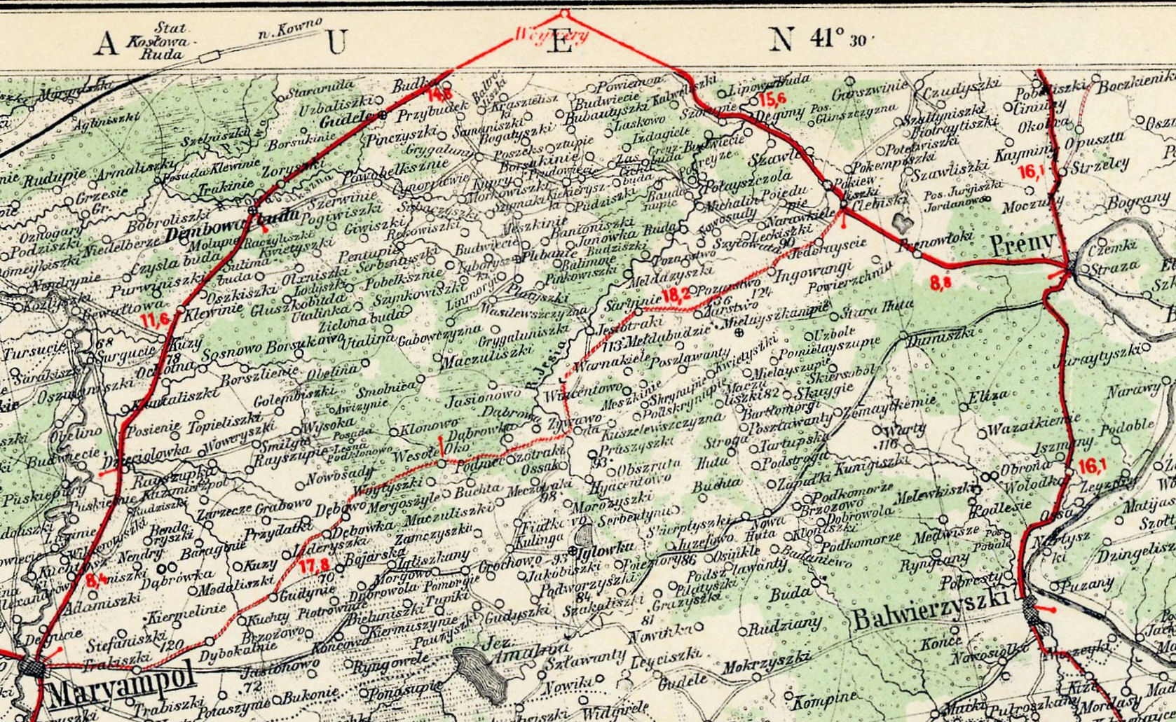
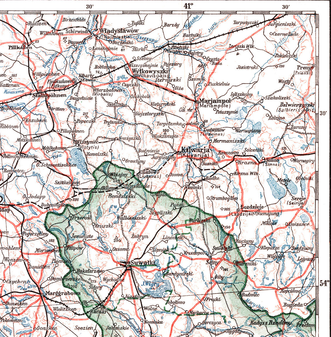
1927-28 "Suwalki 8."

1927-28 "Augustowo. 18"

1925 WIG: "D0 KROLEWIEC,
OLSZTYN, BIALYSTOK,
SUWALKI," 1:750000. Also a
DETAIL image.
OLSZTYN, BIALYSTOK,
SUWALKI," 1:750000. Also a
DETAIL image.
1920's Polish topographical maps (NOT at 1:100000 -- they are on the next page: 1931-38),
created by the Wojskowy(-kownego) Instytut(-u) Geograficzny(-nego) (WIG), Warszawa:
created by the Wojskowy(-kownego) Instytut(-u) Geograficzny(-nego) (WIG), Warszawa:

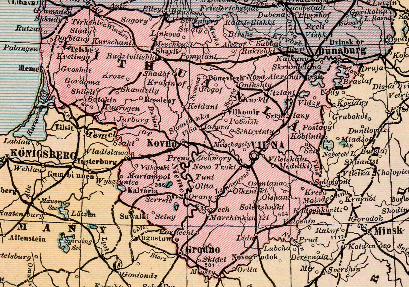

1921 Hammond
Atlas: "RUSSIA,
POLAND, LITHUANIA, LETVIA ESTHONIA, FINLAND."
Also a DETAIL image. (AK)
Atlas: "RUSSIA,
POLAND, LITHUANIA, LETVIA ESTHONIA, FINLAND."
Also a DETAIL image. (AK)
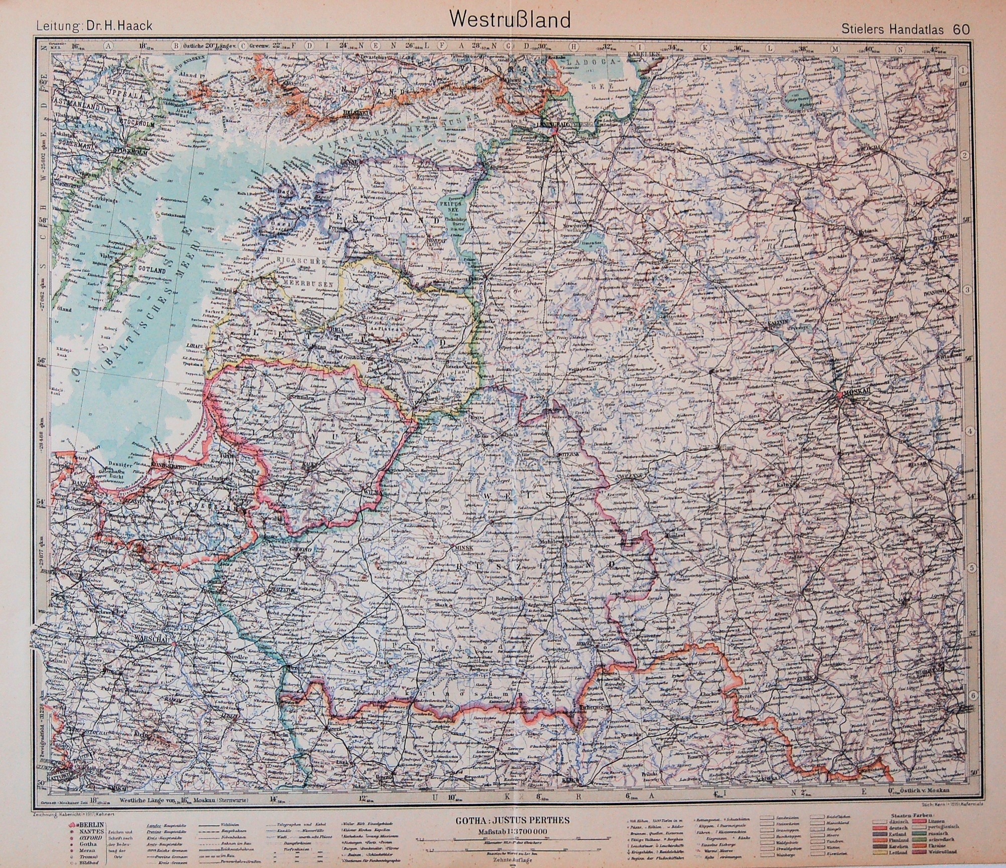
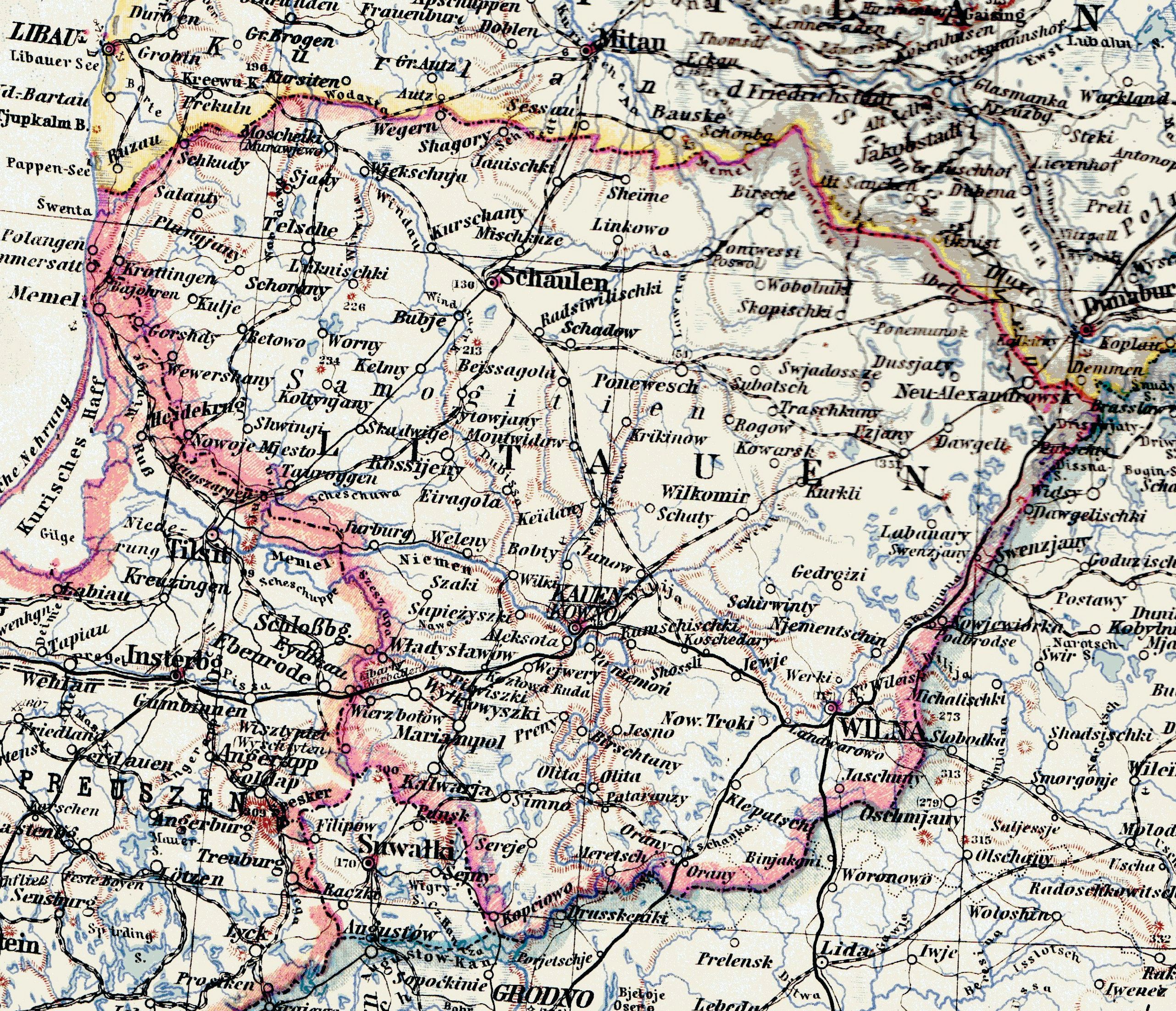
1919 Steilers Handatlas:
"Westrussland," 15 x 19
inches, 1:3700000,
published by Gotha:
Justus Perthes. Also a
DETAIL image. (AK)
"Westrussland," 15 x 19
inches, 1:3700000,
published by Gotha:
Justus Perthes. Also a
DETAIL image. (AK)
Inter-War: The French chocolate company Chocolat Pupier (founded in the 1860's and still available in France today) created collectible
trading cards with the flags, maps, costumes and views of countries of the world -- including Poland, Lithuania, Latvia and Estonia:
trading cards with the flags, maps, costumes and views of countries of the world -- including Poland, Lithuania, Latvia and Estonia:


(A website with a full collection of trrading cards: http://www.flickr.com/photos/taffeta/sets/72157602018755021/
See also a trading card with a view of "Kovno" at the "Views of Lithuania" page.)
See also a trading card with a view of "Kovno" at the "Views of Lithuania" page.)


1921 "Baltischer Lander,"
from Steiler Handatllas (?)
from Steiler Handatllas (?)
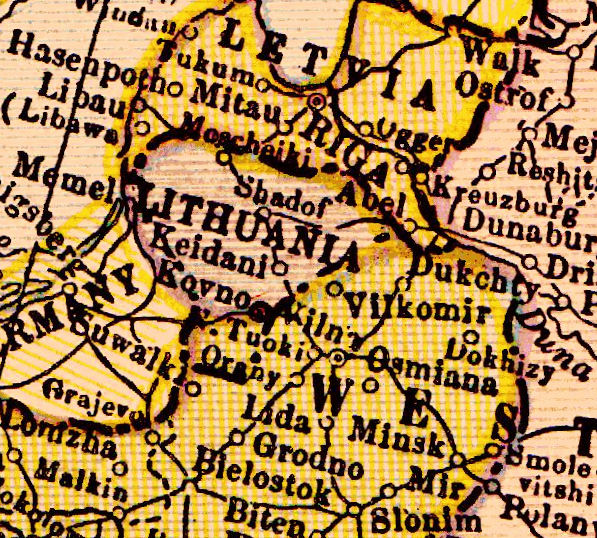
1922 "LITHUANIA," from the Probert
(Online) Encyclopedia:
http://www.probertencyclopaedia.com/
(Online) Encyclopedia:
http://www.probertencyclopaedia.com/
1922 "POLAND," from the
Probert (Online) Encyclopedia:
http://www.probertencyclopaedia.com/
Probert (Online) Encyclopedia:
http://www.probertencyclopaedia.com/


1920 Harmsworth
Atlas: "Baltic
Provinces," London,
8.5 x 12.5 inches,
1:4000000 and a
DETAIL image.
(AK)
Atlas: "Baltic
Provinces," London,
8.5 x 12.5 inches,
1:4000000 and a
DETAIL image.
(AK)


| 1920: "EUROPE," from "Leslie's New World Atlas," 1920, New York., showing their guesstimate of Post WWI boundaries. From www.etc.usf.edu.maps |
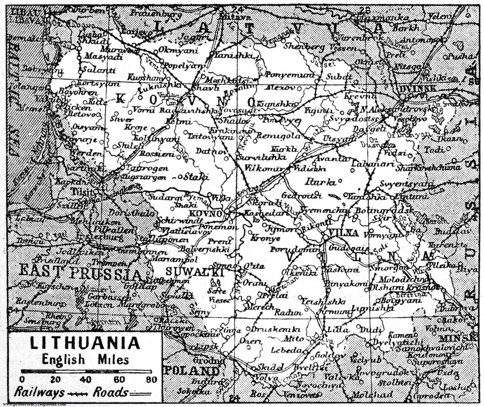
| 1924-25: Nine "REJON WILNO" maps at 1:25000, based on earlier, Russian, maps, were produced by WIG.They are displayed to the right in the order shown in the key map above. From http://english.mapywig.org/ |
1: XII-18-H SUDERWA 2: XXII-18-I RZESZA 3: XXII-19-Z BEZDANY
4: XIII-18-B WIERSZULISZKI
7: XIII-18-E LUDWINOWO 8: XIII-18-F RUDOMINO 9: XIII-19-G RUKOJNIE


6: XIII-19-A NOWA WILEJKA


1930 "Poland and the Baltic," postcard map published by
Išleido VVS Kauno paštininkų Skyr. Vykd. Komitetas. (AK)
Išleido VVS Kauno paštininkų Skyr. Vykd. Komitetas. (AK)

Interwar Years:
"LETTLAND" postcard map
"LETTLAND" postcard map
1923 W. Johnston:
"THE BALTIC
PROVINCES" 5" x 7".
From periodpaper, eBay
"THE BALTIC
PROVINCES" 5" x 7".
From periodpaper, eBay

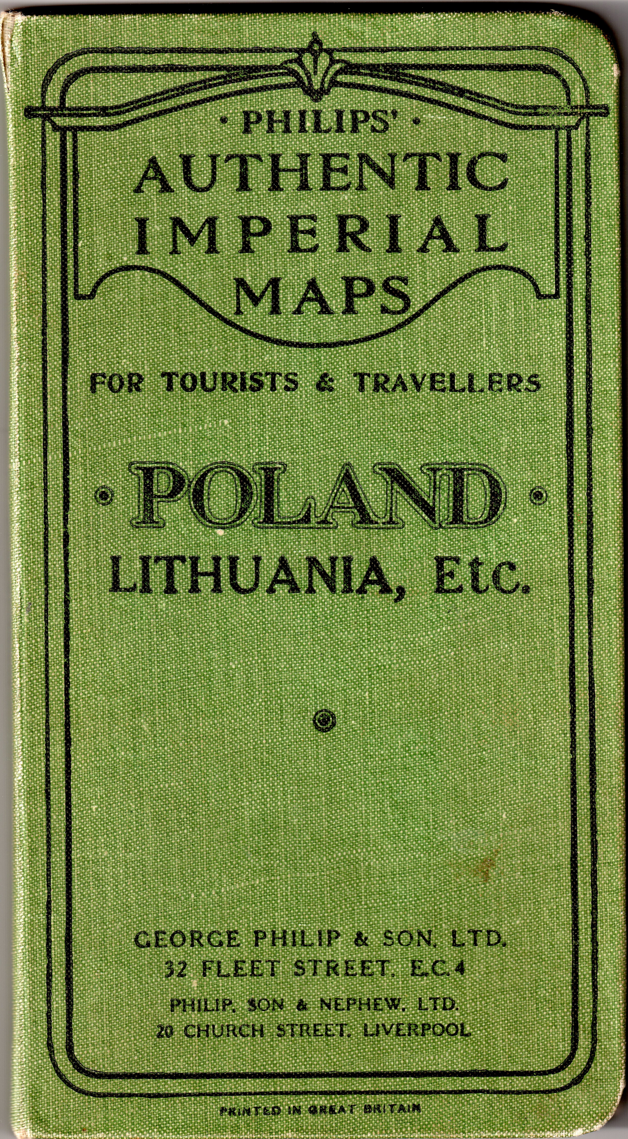
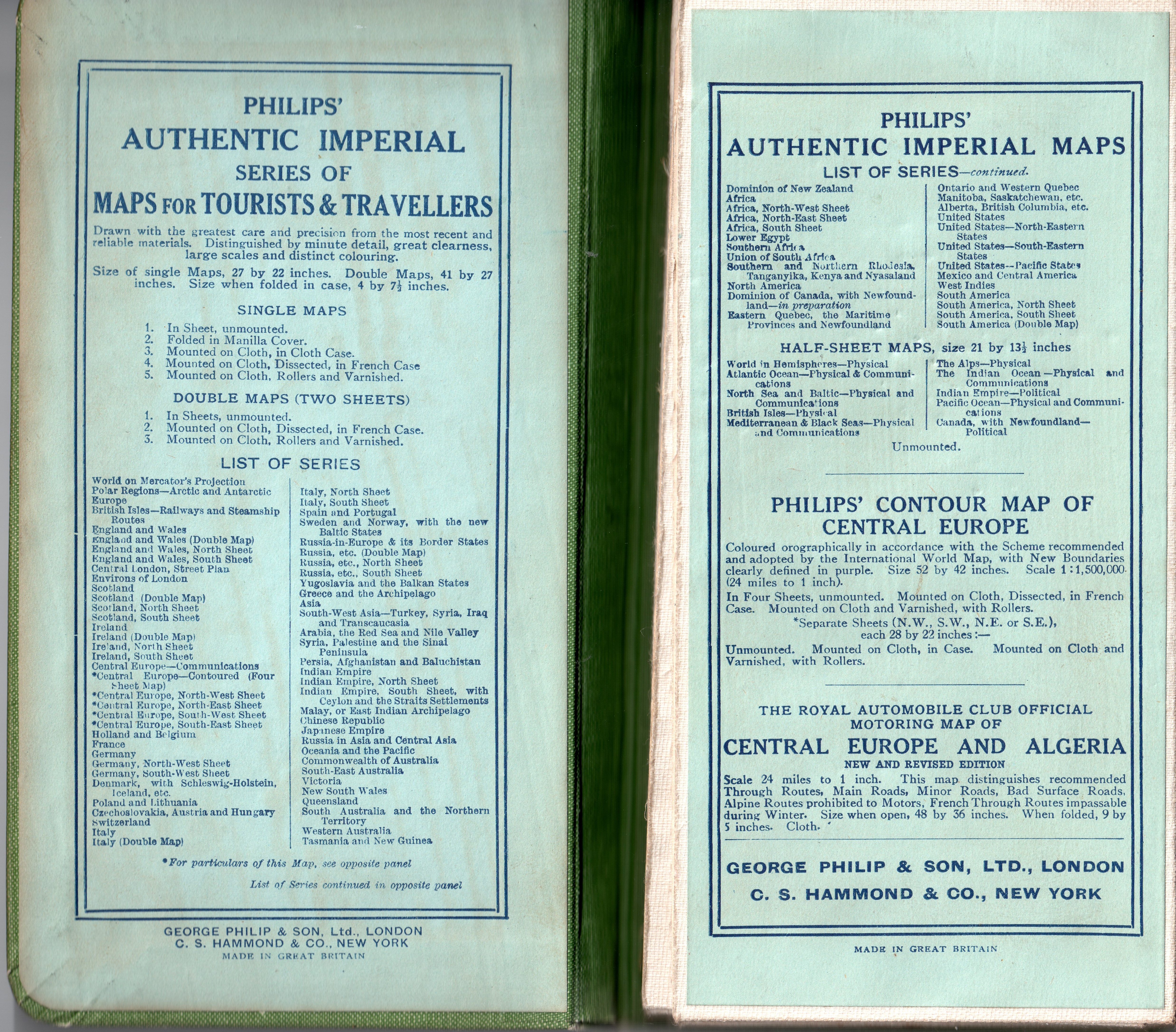

c1930 London Geographical Inst.: "POLAND, with the free
territory OF DANZIG, EAST PRUSSIA and LITHUANIA,"
27 x 22 inches, at 1:500 000. A folded, linen-backed, map
published (undated, as are all maps in the series, which
continued until1988) by George Philip & Son, Ltd.
London, whose roots go back to 1848. Also a DETAIL map
of Lithuania, and images of the front and inside covers.
(AK) Note the southern boundary of Lithuania, which
incorrectly follows too many river courses.


1928 "Polen, Baltische
Randstaaten," Leipzig,
16.5 x 13.5 inches,
and DETAIL, from
the "Minerva Atlas."
From montrealmaps, eBay
Randstaaten," Leipzig,
16.5 x 13.5 inches,
and DETAIL, from
the "Minerva Atlas."
From montrealmaps, eBay

1930 "Polen,"
from a German
atlas. From eBay
from a German
atlas. From eBay

1920 "POLAND," from
"The Victory Atlas of
the World," with
unusual boundaries
for post-war Poland.
"The Victory Atlas of
the World," with
unusual boundaries
for post-war Poland.
