Maps: 1930 - 1939
During the inter-war period, Lithuanian mapmakers leveraged older German and Russian
topographical maps, using Lithuanian place-names. ((Sorry, Yahoo! SiteBuilder software does
NOT support non-English characters, so I cannot show text in proper Lithuanian or Russian.))
topographical maps, using Lithuanian place-names. ((Sorry, Yahoo! SiteBuilder software does
NOT support non-English characters, so I cannot show text in proper Lithuanian or Russian.))


1200 Palanga 1201 Plunge 1202 Telsiai 1203 Luoke 1204 Siauliai 1205 Radviliskis 1206 Pumpenai 1207 Kupiskis
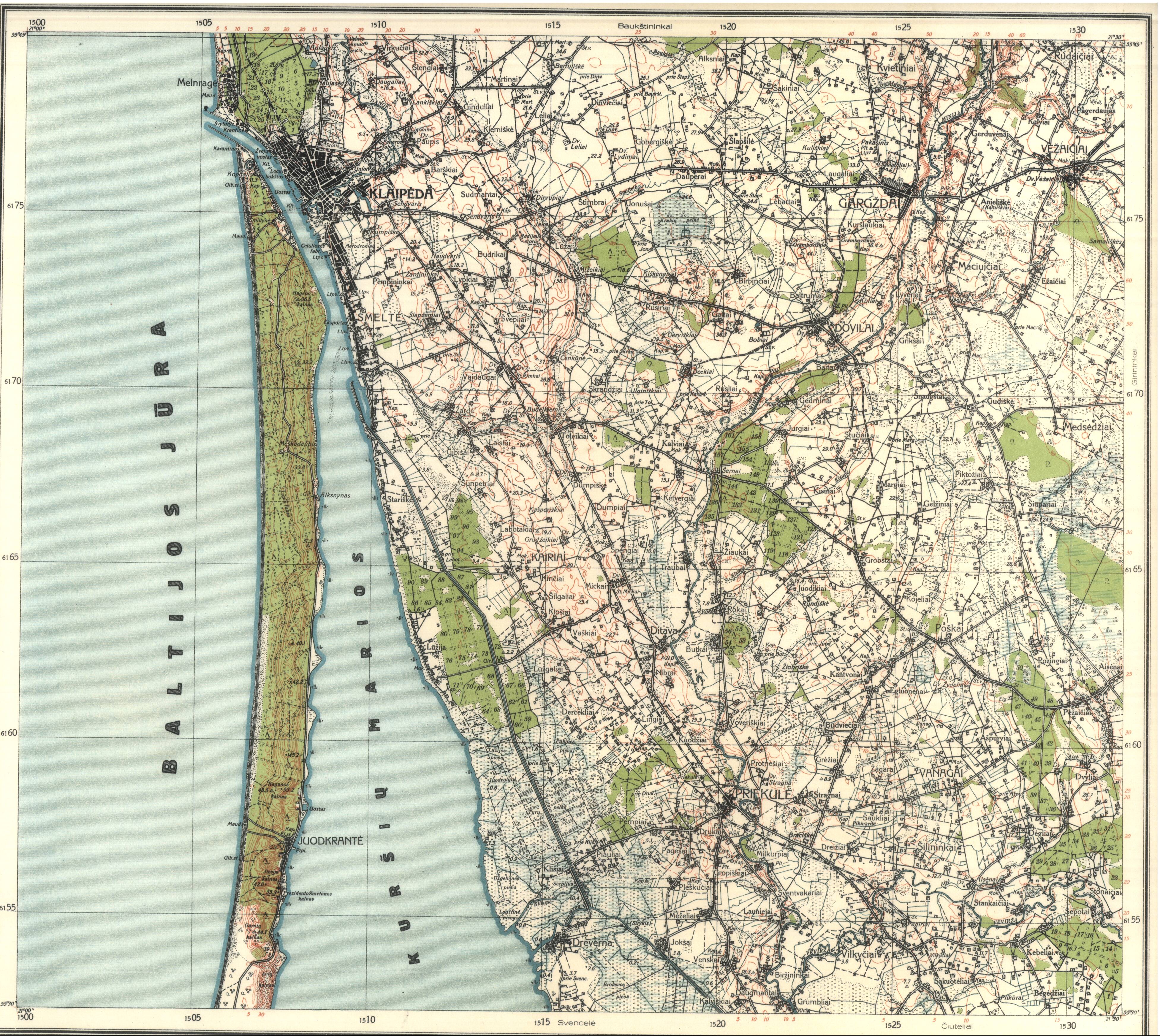


1300 Klaipeda 1301 Rietavas 1302 Varniai 1303 Kelme 1304 Tytuvenai 1305 Grinkiskis 1306 Panevezys 1307 Subacius


1400 Nida 1401 Katyciai 1402 Taurage N 1403 Erzvilkas 1404 Raseiniai 1405 Kedainiai 1406 Seta 1407 Ukmerge

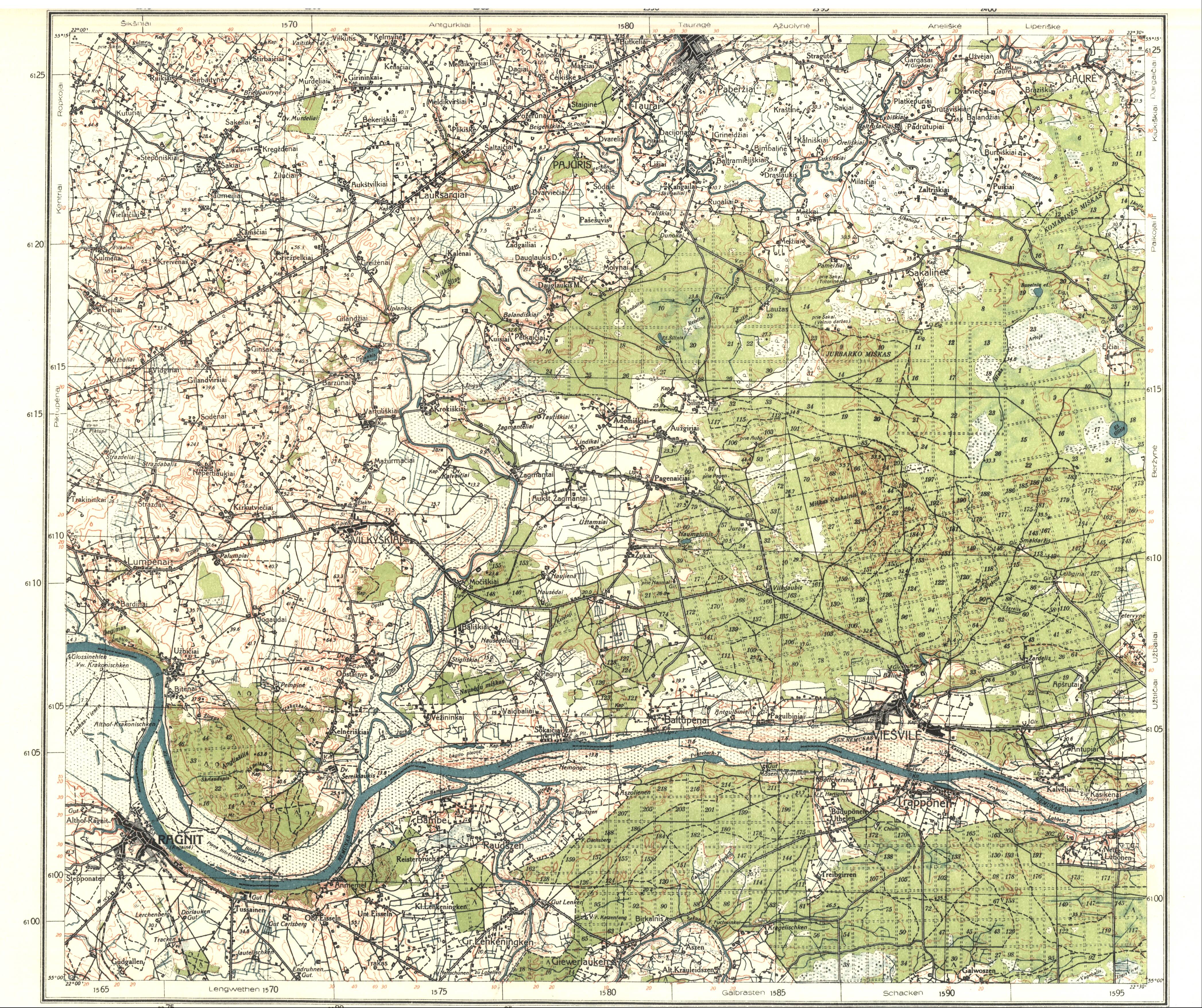


1501 Pagegai 1502 Taurage S 1503 Jurbarkas 1504 Veliuona 1505 Vilkija 1506 Jonava 1507 Sirvintos


1604 Sakiai 1605 Kaunas 1606 Kaisiadorys 1607 Zasliai


1704 Vilkaviskis 1705 Prienai 1706 Butrimonys 1707 Trakai 1708 Vilnius


1805 Simnas 1806 Alytus
From 1923 -1938 the Lithuanian government began an instrumental topographic
survey of Lithuanian territory. Maps at 1:100 000 were compiled for the whole territory
along with 92 sheets at 1:25000. Thumbnails on the right correspond to the map key
above. Also some DETAIL images from the maps, below, out of sequence. (AK)
survey of Lithuanian territory. Maps at 1:100 000 were compiled for the whole territory
along with 92 sheets at 1:25000. Thumbnails on the right correspond to the map key
above. Also some DETAIL images from the maps, below, out of sequence. (AK)
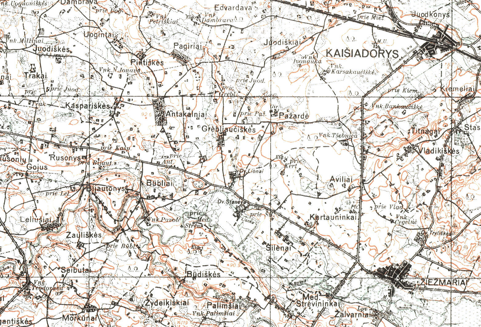
1606 Kaisiadorys Quadrant: DETAIL Ziezmariai

1400 Nida Quadrant: DETAIL Nida
1930's Russian topographical maps, based on 19th century maps:

1931 "LXXIV-A
GRODNO," 1:42000,
based on an 1889 map.
GRODNO," 1:42000,
based on an 1889 map.

1931 "HANUSZYSZKI"
(Onuskis), 1:25000.
(Onuskis), 1:25000.
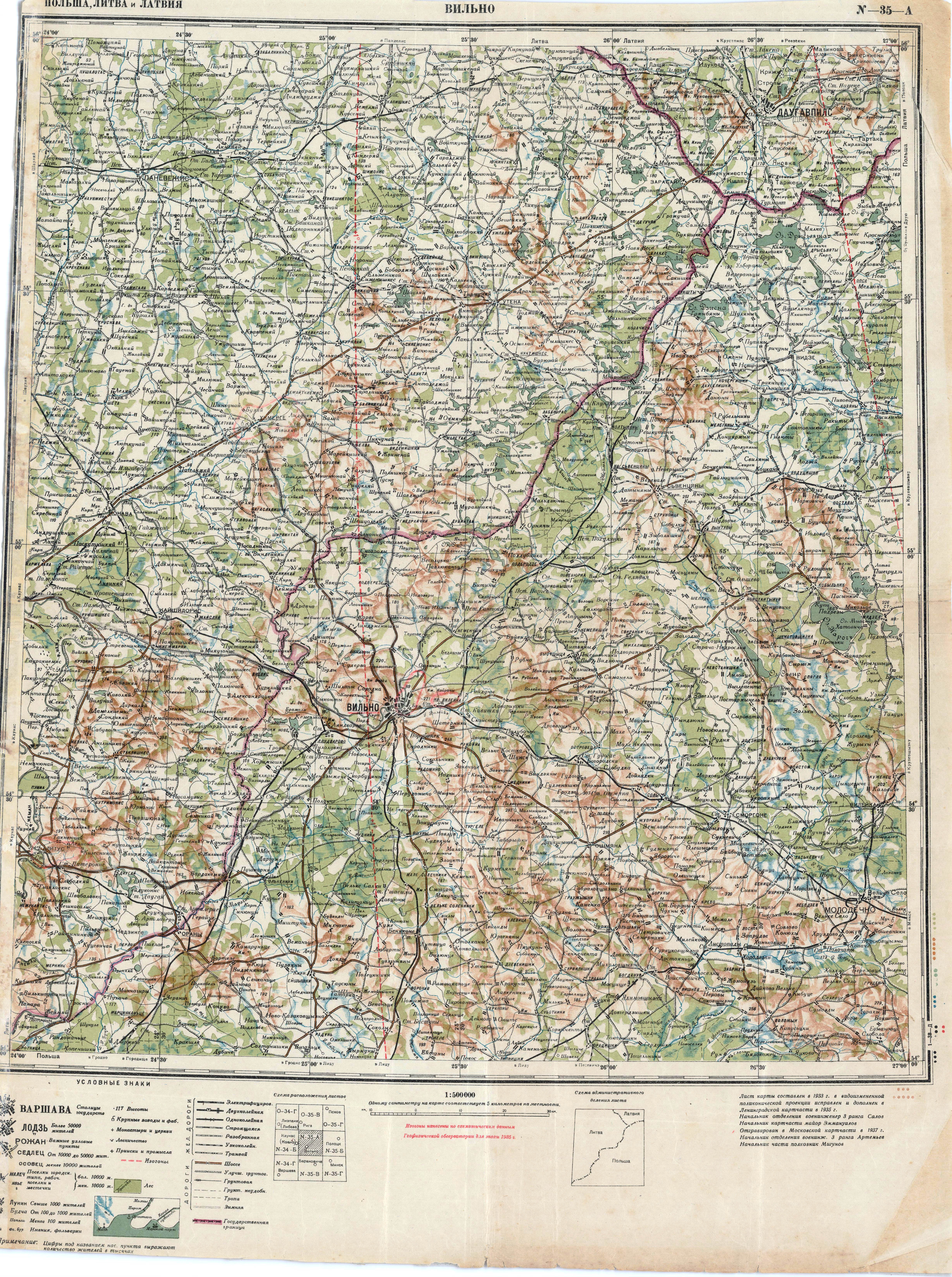
1937 "N-35-A
VILNO," 1:500000.
VILNO," 1:500000.

1938 "O-34-128
PRIEKULE," 1:100000,
based on prior maps
from 1875 onwards.
PRIEKULE," 1:100000,
based on prior maps
from 1875 onwards.
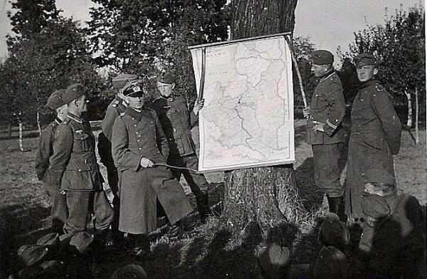
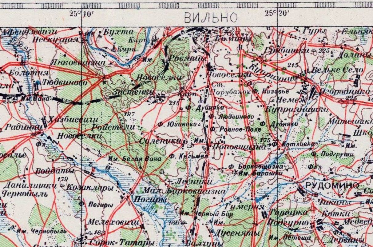
1939 "N-35-VII OSHMYANY," 1:200000. Also a DETAIL image. From www.mapywig.org

1930's Polish topographical maps, created by the Wojskowy(-kownego)
Instytut(-u) Geograficzny(-nego) (WIG), Warszawa:
Instytut(-u) Geograficzny(-nego) (WIG), Warszawa:
1930 WIG: "WILNO,"
1:300000.
1:300000.

1932 WIG: "MARJAMPOL,"
1:100000.
1:100000.
1932 WIG: "36 SUWALKI- KOWNO," 1:300000.
Also a DETAIL image of the Rumsiskes area.
Also a DETAIL image of the Rumsiskes area.


1934-35 "WILNO," in two sheets. Also a DETAIL image.


1935 WIG: "P29 S39
KAISIADORYS
(KOSZEDARY)," 1:100000.
KAISIADORYS
(KOSZEDARY)," 1:100000.

1935 WIG: "P34 S37 GRODNO-
ZACHOD," 1:100000.
ZACHOD," 1:100000.

1935 WIG: "27
WILKOMIERZ," 1:300000.
WILKOMIERZ," 1:300000.

1936 WIG: "25
KLAJPEDA," 1:100000.
KLAJPEDA," 1:100000.

1938 WIG: "26 SIAULIAI
(SZAWLE)," 1:300000.
(SZAWLE)," 1:300000.

1938 WIG: "P32 S36
SUWALKI," 1:100000.
SUWALKI," 1:100000.
1935 SPINDULIO" LIT, Kaunas: "LIETUVOS ZEMELAPIS." (AK)
1938 W. Cukrynski: "REPUBLIKA LITEWSKA," Nakladem Centrali Sprzedazy Map
"Koziej. Olszewski i Filipowicz, Warszawa. From www.mapywig.org
"Koziej. Olszewski i Filipowicz, Warszawa. From www.mapywig.org
World War II:
1939: Sept. 1: Germany invades Poland
Sept. 17: USSR invades Poland
1939: Sept. 1: Germany invades Poland
Sept. 17: USSR invades Poland

Pre-WWII: The French chocolate company Chocolat Pupier (founded in the 1860's and still available in France today) created
collectible trading cards with the flags, maps, costumes and views of countries of the world -- including Poland and Lithuania:
collectible trading cards with the flags, maps, costumes and views of countries of the world -- including Poland and Lithuania:


(See also a trading card with a view of
"Kovno" at the "Views of Lithuania" page.)
"Kovno" at the "Views of Lithuania" page.)

1932 Knauers Welt-Atlas: "Polen,
Baltikum and Ost. Tschecho-
slowakei," 1:7000000. (AK)
Baltikum and Ost. Tschecho-
slowakei," 1:7000000. (AK)


| 1930 Steilers Handatlas: "Estland - Lettland - Litauen," 13.25 x 16.5 inches. 1:1500000. Published by Gotha: Justus Perthes. Also a DETAIL image. (AK) |