Maps: 1482 - 1500
From "Lithuanian historical maps: periods, methods, accuracy and perspectives" by Algimantas Cesnulevicius,
Giedre Beconyte (See link at "Articles" page on this site):
"The first geographical data about the territory of Lithuania are found in the works of Ancient Greeks and Romans. In the third
book of the “Geographical Guide” by Claudius Ptolemy (Fig. 2 below) there is a description of the Baltic area. Unfortunately, the
original map has not survived until recent time. At the present we know several maps of Central Europe compiled according to
the data given by Ptolemy. In the Middle Ages these sparse and inaccurate data of the Antique geography about Lithuanian
territory were almost lost. Only some maps of that time, such as Al–Idrissi of the Hereford maps, do represent the main rivers of
Lithuania. In the magnificent map of Fra Mauro (15th century) the name of Lithuania has been mentioned. The first and more
detailed cartographic view of Lithuania since the Antique times, appeared in the second half of the 15th century, in the epoch of
the Renaissance and geographical discoveries."
Who are the founding map-makers of the historic Lithuanian area? According to an essay at:
"The catalogue is preceded by a short essay on some outstanding cartographers’ works, including maps of Poland belonging to
the collection of Rapperswil. Some celebrities of cartography are mentioned due to their input in the development of the
presentation of the part of Europe in question: they include Ptolemy, Wapowski, Grodecki and Wilhelm le Vasseur de Beauplan.
On the other hand, there is no mention on such luminaries as Ortelius, Mercator, Blaeu or Sanson, as they had no influence on the
development of cartography of the area in question, although their works included maps of Poland, Lithuania, Ukraine, Silesia
and Livonia. "
1482 Francesco Nicolo di Berlinghieri:
"TABVLA SECONDA DE ASIA." From Muzeum
Polskie Rapperswil, Switzerland
"TABVLA SECONDA DE ASIA." From Muzeum
Polskie Rapperswil, Switzerland


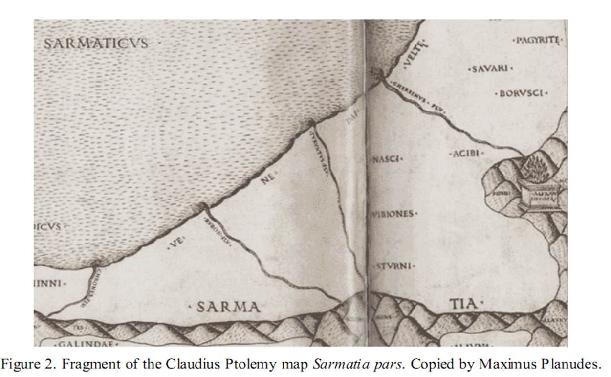
Claudius Ptolemy: "Sarmatia pars" as
reproduced in "Lithuanian historical maps:
periods, methods, accuracy and perspectives"
reproduced in "Lithuanian historical maps:
periods, methods, accuracy and perspectives"
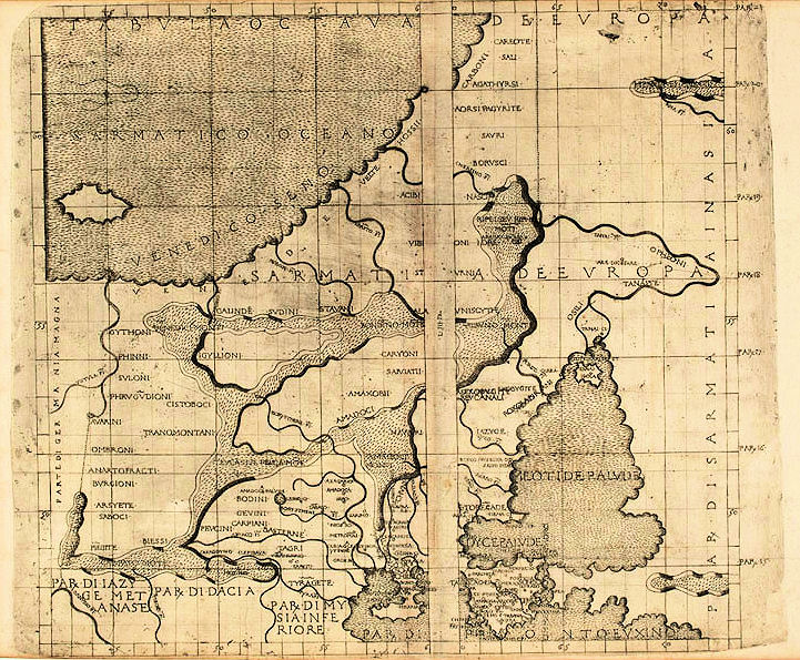
1490 Claudius Ptolemy: "Octava
Evropae Tabvla"
Evropae Tabvla"

1493 Hartman Schedel (Publisher)- Hieronymus Munzer (Editor)- Michael Wolgemut (Engraver): "Europa," from the "Nuremberg
Chronicle," in colored and uncolored versions. Also a DETAIL image of the colored version, from: http://www.nada.kth.se/~ovidiu/maps/;
the uncolored version is from www.bergbook.com
Chronicle," in colored and uncolored versions. Also a DETAIL image of the colored version, from: http://www.nada.kth.se/~ovidiu/maps/;
the uncolored version is from www.bergbook.com

1482 Francesco Nicolo di Berlinghieri:
"TABVLA SECONDA DE ASIA." From
National Museum of Lithuania
"TABVLA SECONDA DE ASIA." From
National Museum of Lithuania
