Maps: 1601 - 1623
Abraham Ortelius (original mapmaker) - Philip Galle (engraver who down-sized the original plate): "POLONIA," a map from his landmark 1570 "Theatrum orbis terrarum" (Theatre of the
world) re-drawn by his collaborator Philip Galle for the first pocket atlas: "Epitome Theatri Ortelani," Antwerp, 5 x 3.5 inches, published by Jan Baptise Vrients (who received rights to
Ortelius' plates in 1601), in French, Latin, Italian and German editions, republished in authorized and plagiarized versions by various publishing houses until 1724. See publication
dates/publishers /sources above.
Commentary from Laura Guelle at brynmawr.edu
Petrus Bertius (cartographer) - Jodocus Hondius (cartographer/engraver): "POLONIA," Amsterdam, 3.5 x 5 inches / 90 x 125 mm, in five different versions, from different editions
of Bertius's "Tabularum Geographicarum Contractarum," publsihed by Cornelium Nicolai. First published 1598 in his "Caert- Thresoor."
of Bertius's "Tabularum Geographicarum Contractarum," publsihed by Cornelium Nicolai. First published 1598 in his "Caert- Thresoor."

1603 Vaclovas Grodeckis - Abraham Ortelius: "POLONIAE, LITVANÆ Q DESCRIPTIO." Antwerp, 15 x 19 inches / 48.5
cm x 37.5 cm image, in versions from the Latin version of "Theatrum Orbis Terrarum." The image was engraved by
Jan Baptist Vrients in 1595, and was based on an earlier map by the geographer/engraver Grodeckis, which was itself
based on an earlier map by Bernard Wapowski, published in 1526. Compare with the 1595 - 1612 versions.

1607 Gerard Mercator -
Jodocus Hondius:
"LITHUANIA," 5.5 x 7.25
inches, from "Atlas
Minor." AK-10, and from
www.davidrumsey.com
Jodocus Hondius:
"LITHUANIA," 5.5 x 7.25
inches, from "Atlas
Minor." AK-10, and from
www.davidrumsey.com
c. 1609-10 Gerard Mercator - Jodocus Hondius: "LITHUANIA," 13.8mm x 181mm, in eight different versions in various languages published around
the same time from "Atlas Minor." Note "LITHVANIE" above the first, sixth and eighth map image; "LITHVANIA" above both the second map, and the
third, colored, map. Compare with the 1621 version below, which has "Lithuania" above the frameline.
the same time from "Atlas Minor." Note "LITHVANIE" above the first, sixth and eighth map image; "LITHVANIA" above both the second map, and the
third, colored, map. Compare with the 1621 version below, which has "Lithuania" above the frameline.
1613 [dated] - 1645 Hessel Gerritsz (engraver) - Willem Blaeu (mapmaker/publisher): "MAGNI DVCATVS LITHVANIAE," 28.9 x 29.3 inches, Amsterdam. An important 4-sheet wall map engraved (all such maps have the date "1613" on
the second cartouche) from survey drafts prepared by M. Strubicz under instructions of Prince Nicolas Christophe Radziwill (Lithuanian: Mikalojus Kristupas Radvila). These examples are by Willem Blaeu, under his imprint
“Guilhelmus Janssoni." This map was not included in an atlas until 1630. These examples have a tiny town vignette at the location for Memel, but no label. "Der Memel" was apparently added in a French version of the atlas in 1645,
and in Flemish and German atlases beginning 1647 .

1620 Mercator - Johannes Janssonius: "LITHUANIA," 14.5 x 20 cm /
5.7 x 8 inches, from Mercator's "Atlas Minor," in two versions. See
versions from 1625, 1648 and 1651.
5.7 x 8 inches, from Mercator's "Atlas Minor," in two versions. See
versions from 1625, 1648 and 1651.


Petrus Bertius: (publisher) - Barent Langenes (publisher) - Cornelius Claesz (publisher): "Livoniæ descrip," Amsterdam & The Hague, 3.4 x 4.9 inches / 8.7 x 12.4 cm., in six depictions,
from various versions and languages: Dutch, French and Latin, of a miniature atlas first published in 1598, with editions through 1609. The plate, with a characteristic diagonal
scratch, could have been engraved by Petrus Kaerius or Jodocus Hondius.
from various versions and languages: Dutch, French and Latin, of a miniature atlas first published in 1598, with editions through 1609. The plate, with a characteristic diagonal
scratch, could have been engraved by Petrus Kaerius or Jodocus Hondius.

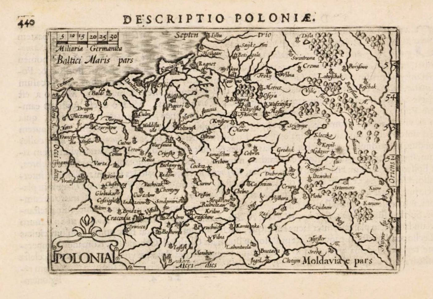
Petrus Bertius: "POLONIA," Amsterdam, 5 x 3.5 inches / 95 x 135 mm, in versions engraved by Hondius and printed from the second plate of two used to illustrate his pocket atlas
"Tabularum geographicarum contractarum'" (first published 1612), with thicker printed borders. The maps from this atlas are largely reductions from a Mercator-Hondius atlas.
"Tabularum geographicarum contractarum'" (first published 1612), with thicker printed borders. The maps from this atlas are largely reductions from a Mercator-Hondius atlas.
Gerard Mercator (mapmaker) - Jodocus Hondius (publisher): "LITHVANIA," Amsterdam, in versions in varying sizes (the second 1619 map is 37 x
44 cm / 14.57 x 17.32 inches, and has French text on the verso) published at various times. Mercator's first edition of this map appeared in 1595.
Jodocus Hondius purchased Mercator's plates in 1604, and editions continued after Hondius' death in 1612.
44 cm / 14.57 x 17.32 inches, and has French text on the verso) published at various times. Mercator's first edition of this map appeared in 1595.
Jodocus Hondius purchased Mercator's plates in 1604, and editions continued after Hondius' death in 1612.


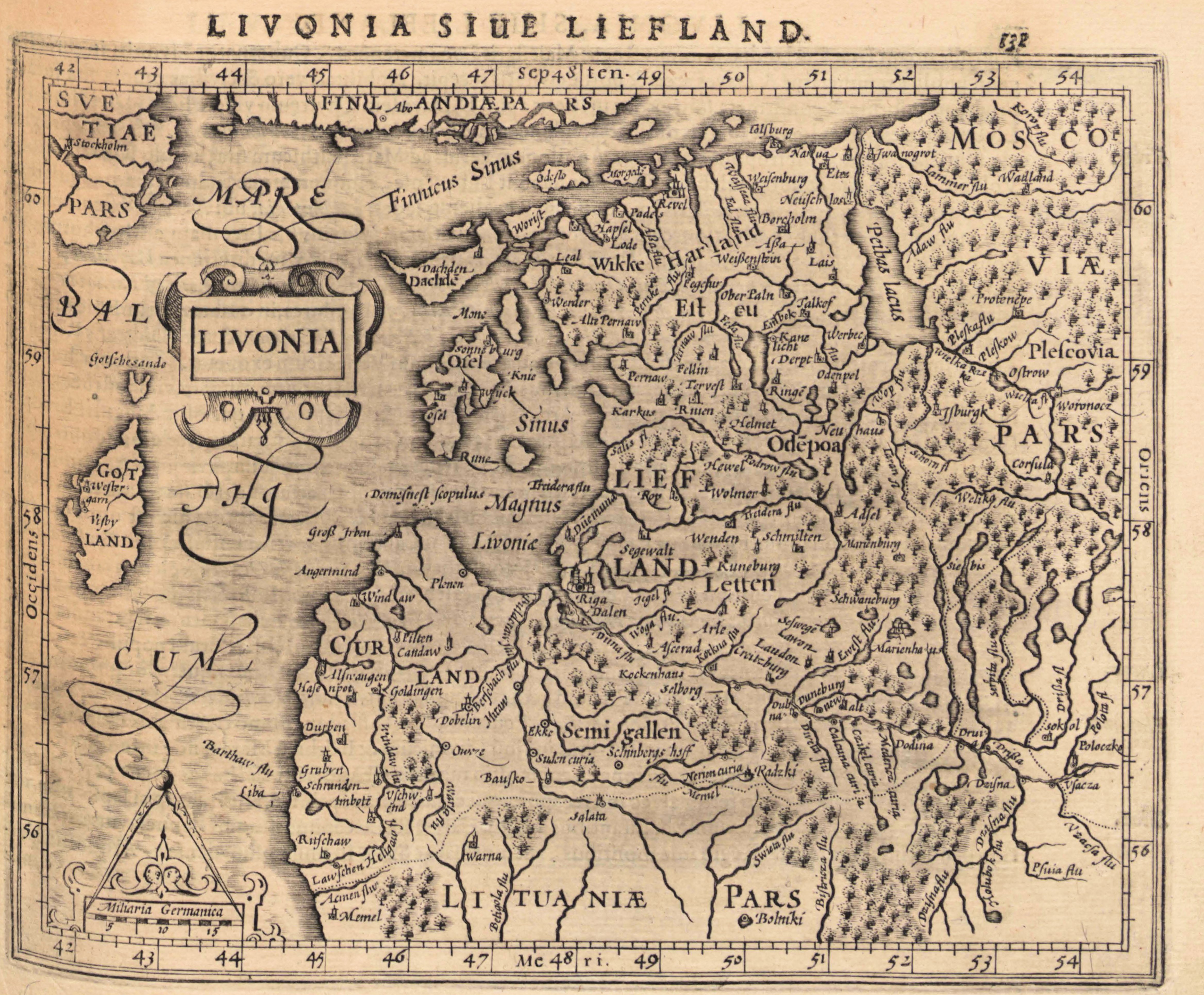
1621 Gerard Mercator: "LIVONIA,"
Arnheim, from his "Atlas Minor," published
by Johannes Janssonius. From the Univ. of
Tartu: http://dspace.utlib.ee/dspace/
Arnheim, from his "Atlas Minor," published
by Johannes Janssonius. From the Univ. of
Tartu: http://dspace.utlib.ee/dspace/
| 1606 Univ. of Tartu: http://dspace.utlib.ee/dspace/ |
Vaclovas Grodeckis - Abraham Ortelius: "POLONIAE, LITVANÆ Q DESCRIPTIO." 15 x 19 inches, in four versions
published in Antwerp: the 1608s are from "Theatro Del Mondo Di Abrahamo Ortelio," the first edition printed with
Italian text, a translation by Pigafetta which Ortelius' heirs sold to Vrients, who printed and published it. The 1609
and 1612 versions are from "Theatrum Orbis Terrarum," which includes corrections by Van Den Broecke on the
Dniester River, first made 1598. The map is based upon the maps of Grodeckis, published in 1558 and 1562, corrected
by Pograb- ka, engraved by Hogenberg. Grodecki's map is based on a 1526 map by Wapowsky.


1601 - 1612 Abraham Ortelius (cartographer) - Jan Baptiste Vrients (publisher) - Michel Coignet (text author): "LIVONIA," Antwerp, 3.3 x 4.5 inches / 8.5 x 11.5 cm. Miniature
editions of Ortelius' atlas (who died 1598) were published 1601-12 by Vrients: "Epitome theatri orbis terrarum Abrahami Ortelij." The engravings were done by Ambrose and
Ferdinand Arsenius. The maps were copied from, and considered superior to, those in Philip Galle's 1598 edition of the Epitome. The version reliably dated 1604 is from the
Hulsius German language edition published in Frankfurt.


| 1602 www.beachmaps.com |
| 1609 www.alteagallery.com |
| 1603 eBay |
Petrus Bertius (cartographer) - Jodocus Hondius (engraver/brother-in-law of Bertius): "LIVONIÆ DESCRIP." Amsterdam, 13 x 9 cm, in versions after
Ortelius, from "Tabularum Geographicarum Contractarum…"
Ortelius, from "Tabularum Geographicarum Contractarum…"

| 1618 National Library of Latvia: http://data.lnb.lv |
1603 - 1604 Abraham Ortelius: "LIVONIA," Antwerp,
published by Jan Baptiste Vrients in English editions of
Ortelius' atlas.
published by Jan Baptiste Vrients in English editions of
Ortelius' atlas.
1613 Gerard Mercator:
"LIVONIA," France, 14.5
x 19 cm, from "Atlas
Minor." From the National
Library of Latvia:
http://data.lnb.lv
"LIVONIA," France, 14.5
x 19 cm, from "Atlas
Minor." From the National
Library of Latvia:
http://data.lnb.lv


| 1600-1606 www.jpmaps.couk |
| 1603 Estonian National Library: www.nlib.ee |
| 1606 lindisfarneprints @btinternet.com |
| 1606 www.swaen.com |

1612 Barent Langenes:
"Livoniæ descrip."Am-
sterdam, 5 x 3.5 inches,
first issued in his "Caert-
Thresoor," later re-pub-
lished by Bertius in his
Tabularum Geograph-
icarum, beginning 1600.
From www.raremaps.com
"Livoniæ descrip."Am-
sterdam, 5 x 3.5 inches,
first issued in his "Caert-
Thresoor," later re-pub-
lished by Bertius in his
Tabularum Geograph-
icarum, beginning 1600.
From www.raremaps.com

| 1606 lindisfarne2 on eBay |


| 1602 bertius on eBay |

1612 Barent Langenes:
"POLONIA," Amsterdam,
5 x 3.5 inches, in an
early state of a map
which first appeared in
1598, later re-published
by Bertius beginning in
1600. From www.
raremaps.com
"POLONIA," Amsterdam,
5 x 3.5 inches, in an
early state of a map
which first appeared in
1598, later re-published
by Bertius beginning in
1600. From www.
raremaps.com


1613 Hessel Gerritsz (engraver) - Willem Blaeu: (publisher, under his imprint Guilhelmus
Janssoni): "MAGNI DVCATVS LITHVANIÆ," in its original iteration as a wall map -- it
would not be published in an atlas until 1630. The written commentary added to this
map was prepared by Tomasz Makowski, who is often mistakenly given credit for
engraving the map.
Janssoni): "MAGNI DVCATVS LITHVANIÆ," in its original iteration as a wall map -- it
would not be published in an atlas until 1630. The written commentary added to this
map was prepared by Tomasz Makowski, who is often mistakenly given credit for
engraving the map.


1607 Gerard Mercator -
Jodocus Hondius:
"Livonia," from "Atlas
Minor." Compare with
the 1621 version. From
www.davidrumsey.com
Jodocus Hondius:
"Livonia," from "Atlas
Minor." Compare with
the 1621 version. From
www.davidrumsey.com

| 1601 Vrients www.alabamamaps.ua.edu |
| 1601 Vrients www.polona.pl |
| c. 1601 Galle-Vrients www.raremaps.com |
1604

| 1603 Shaw, London New York Public Library: https://digitalcollections.nypl.org/ |
| 1609 Vrients antiqueatlas on eBay |
| 1609 Vrients www.swaen.com |


| 1601 Coignet - Vrients www.oldworldauctions.com |
| 1606 www.swaen.com |

1608 Gerard Mercator (mapmaker) -
Pieter Van Den Keere (engraver) - J.E.
Cloppen- burgh (publisher): "LIVONIA,"
Amsterdam, 7.5 x 10.1 inches / 19.0 x
25.7 cm. From the first French-text
edition of Jodocus Hondius' "Atlas
Minor." Also a DETAIL image. From
www.swaen.com
Pieter Van Den Keere (engraver) - J.E.
Cloppen- burgh (publisher): "LIVONIA,"
Amsterdam, 7.5 x 10.1 inches / 19.0 x
25.7 cm. From the first French-text
edition of Jodocus Hondius' "Atlas
Minor." Also a DETAIL image. From
www.swaen.com

1621 Gerard Mercator -
Jodocus Hondius:
"Lithuania," Amsterdam,
7 x 7 inches. Notice
"Lithuania above the
frameline. Compare with
1609-10 versions. From
www.themaphouse.com
Jodocus Hondius:
"Lithuania," Amsterdam,
7 x 7 inches. Notice
"Lithuania above the
frameline. Compare with
1609-10 versions. From
www.themaphouse.com

Gerard Mercator (mapmaker) - Jodocus Hondius (publisher): "LIVONIA," Amsterdam, 5.9 x 7.4 inches. / 15.0 x 18.7 cm, with the 1608 version
from the first French-text edition of Hondius' "Atlas Minor."
from the first French-text edition of Hondius' "Atlas Minor."

| 1609 www.raremaps.com |
| 1612 www.swaen.com |

| 1608 www.davidrumsey.com |

1608 Portant (1571 map-
maker; used by Ortelius
1573 onwards & De Jode,
1578) - Vrients (publisher):
"LIVONIAE NOVA
DESCRIPTIO." Antwerp,
one of 3 maps on the plate.
From www.davidrumsey.com
maker; used by Ortelius
1573 onwards & De Jode,
1578) - Vrients (publisher):
"LIVONIAE NOVA
DESCRIPTIO." Antwerp,
one of 3 maps on the plate.
From www.davidrumsey.com


| "Scala milliarum: 10, 20, 30" |
| "Scala milliarum: 10, 20, 30, 40" redrawn labeling |

| 1616 National Library of Latvia: http://data.lnb.lv |
| 1616 www.leejacksonmaps.com |
| 1618 digital.ub.uni-duesseldorf.de |
| 1607 www.raremaps.com |
| 1610 www.swaen.com |
| 1613-16 www.sanderusmaps.com |
| 1619 www.raremaps.com |
| 1623 www.raremaps.com |
| c. 1601 Galle-Vrients www.leejacksonmaps.com |
| 1601 antique.maps on eBay |
| www.raremaps.com |
| www.the antiquarium. com |
| www.wenner.net |
| regiomontanus on eBay |
| www.swaen.com |
| Naional Library of Estonia: http://www.nlib.ee |
| National Library of Latvia: http://data.lnb.lv |
| National Library of Latvia: http://data.lnb.lv |
| www.oldworldauctions.com |
| National Library of Estonia: http://www.nlib.ee |
| National Library of Latvia: http://data.lnb.lv |
| www.librarie-lebail.fr |
| www.raremaps.com |
| National Library of Latvia: http://data.lnb.lv |
| www.oldworldauctions.com |
| www.sanderusmaps.com |
| boughettiarte on eBay |
| 1635 www.raremaps.com |
| 1635 www.raremaps.com |
| c. 1635 www.raremaps.com |
| c. 1635 www.raremaps.com |
| www.geoportal.lt |
| 1616 bertius on eBay |
| 1616 www.alteagallery.com |
| 1618 digital.ub.uni-duesseldorf.de |
| 1618 www.oldworldauctions.com |
| National Library of Latvia: http://data.lnb.lv |

| Antique.maps on eBay and www.antique-maps.lt |

| 1604 bertius on eBay: Beach Antique Maps and Prints |
c. 1619 Gerard Mercator: "LIVONIA, "Amsterdam, 36.5 x 47.3 cm / 14¼ x 18½
inches. First published 1595; see 1627 & 1630 versions.
inches. First published 1595; see 1627 & 1630 versions.

1601 Abraham Ortelius
(mapmaker) - Jan
Baptiste Vrients
(publisher): "LIVONIA,"
from a Latin edition of
"Epitome Theatri
Orteliani." From www.
oldworldauctions.com
(mapmaker) - Jan
Baptiste Vrients
(publisher): "LIVONIA,"
from a Latin edition of
"Epitome Theatri
Orteliani." From www.
oldworldauctions.com
| Antique.maps on eBay and www.antique-maps.lt |

| 1619 www.sanderusmaps.com |


| 1608 www.swaen.com |

| 1610 www.oldworldauctions.com |

| c. 1608-10 Latvian National Digital Library: www.dom.lndb.lv |

| 1616 www.raremaps.com |

1617 Giovanni Antonio Magini (carto-
grapher) - Girolamo Porro (publisher) -
Johannes Jansson (printer):
"POLONIAE REGNVM," Arnheim,
from "GEOGRAPHIAE: CLAUDIO
PTOLEMÆ I." Compare with the first
Magini version, 1596. From
antiqua-trinacria on eBay
grapher) - Girolamo Porro (publisher) -
Johannes Jansson (printer):
"POLONIAE REGNVM," Arnheim,
from "GEOGRAPHIAE: CLAUDIO
PTOLEMÆ I." Compare with the first
Magini version, 1596. From
antiqua-trinacria on eBay

| c. 1603 Shaw, London www.furneuxantiquemaps.com |

| 1623 www.swaen.com |

| 1613 www.oldworldauctions.com |

| 1607 www.swaen.com |


| 1616 bertius on eBay |

1621 Jodocus Hondius
(original engraver) -
Nicolaes de Clerck (car-
tographer/engraver) -
Petrus Bertius (original
publisher) - Jan Cloppen-
burgh (current publisher):
"POLONIA," Amsterdam,
3.7 x 5.2 inches, from the
Dutch book "Wereld
Spiegel..," a translation
of Pierre Davity's "Les
estats, empires et
principautez de monde."
Cloppenburgh probably
borrowed the Bertius
plate. From www.swaen.com


| 1608 Folger library via wikimedia |


| Uppsala Univ. Library via Alma Braziūnienė, Univ. of Vilnius |

| The Weimar map, via Alma Braziūnienė, Univ. of Vilnius |

| National Library of Poland via www.mapywig.org |
| www.raremaps.com |


| www.raremaps.com |

| 1619 www.raremaps.com |

| 1630 www.raremaps.com |

| 1634 www.sanderusmaps.com |

| 1641 www.lpmaps.lt |

| 1643 www.antique-maps.lt |


| 1618 bertius on eBay |
| NEW March 30 |