Maps: 1756 - 1763
1757 Thomas Kitchin: "MAP of the several Countries thro which the
Russians are to pass in their March to PRUSSIA," London, 8 x 10
inches from Gentleman's Magazine.
Russians are to pass in their March to PRUSSIA," London, 8 x 10
inches from Gentleman's Magazine.
1757 [dated 1752] Didier Robert de Vaugondy: "Le Royaume de Pologne divisé en ses duchés et provinces et subdivisé en Palatinats," Paris, 48 x 54
cm., from the first plate/edition of his "Atlas Universel" (reissued to 1799), with the cartouche notation: "Geographe ordinaire du Roi. Avec Privilege
1752." All such maps are dated 1752.
cm., from the first plate/edition of his "Atlas Universel" (reissued to 1799), with the cartouche notation: "Geographe ordinaire du Roi. Avec Privilege
1752." All such maps are dated 1752.

1758 Willem Bachiene -
Covens & Mortier: "ESTATS
de la COURONNE de
POLOGNE," Utrecht, 5.9 x
5.1 inches. From 'Kort
begrip der Oude en Nieuwe
Staatkundige Geographie."
See the 1711 Laso base. From
theprintscollector on eBay
Covens & Mortier: "ESTATS
de la COURONNE de
POLOGNE," Utrecht, 5.9 x
5.1 inches. From 'Kort
begrip der Oude en Nieuwe
Staatkundige Geographie."
See the 1711 Laso base. From
theprintscollector on eBay

1759 Claude Buffier: - F. Desbrulins (engraver): "LA
POLOGNE Suivant les degrés de l'Académie des
Sciences de Paris.” Paris, image 5 3/8 x 7 inches, from
the Giffart "Geographie Universelle."
POLOGNE Suivant les degrés de l'Académie des
Sciences de Paris.” Paris, image 5 3/8 x 7 inches, from
the Giffart "Geographie Universelle."

1759 Johann Homann:
"REGNI POLONIÆ
MAGNIQUE DUCATUS
LITHUANIÆ." From
www.oldworldmaps.com
"REGNI POLONIÆ
MAGNIQUE DUCATUS
LITHUANIÆ." From
www.oldworldmaps.com

1759 [dated] Tobias Conrad Lotter (engraver/publisher) - August Vindel (geographer): "Mappa Geographica, ex novifsimus obfservationibus repraefentans Regnum Poloniӕ et Magnum Ducatum Lithuaniӕ," Augsburg, 19.4 x 23.4
inches, in four differently-colored versions of a map probably based on one by Seutter, his father-in-law. See the 1772 updated version, in which the "1759" date on the last line has been inexpertly erased.
inches, in four differently-colored versions of a map probably based on one by Seutter, his father-in-law. See the 1772 updated version, in which the "1759" date on the last line has been inexpertly erased.

1760 [dated] Thomas Bowen: "An Accurate Map of
Poland, Prussia & Lithuania..," London, 9 x 7 inches,
from the General Magazine of Arts & Sciences.
Poland, Prussia & Lithuania..," London, 9 x 7 inches,
from the General Magazine of Arts & Sciences.

1760 [dated] Nicolas de
Fer - (original
mapmaker, publisher,
1716, 1736) - Peter
Starckman (original
engraver) -
Louis-Charles Desnos
(publisher, 1760, 1782):
"LES ÉTATS DE LA
COURONNE DE
POLOGNE..," Paris, 18.5
x 23.2 inches / 47.0 x
59.0 cm,.
Fer - (original
mapmaker, publisher,
1716, 1736) - Peter
Starckman (original
engraver) -
Louis-Charles Desnos
(publisher, 1760, 1782):
"LES ÉTATS DE LA
COURONNE DE
POLOGNE..," Paris, 18.5
x 23.2 inches / 47.0 x
59.0 cm,.

1760 [dated] dedicated to astronomer/geographer Jean
Janvier, created and engraved by François- Nicolas
Martinet, published by Jean Lattre: "Les Royaumes de
Pologne et de Prusse Avec Le Duche de Curlande...,"
Paris, 25.5 x 18.5 inches. First edition: later, more
common editions were published in 1774 and 1780.
Both from www.raremaps.com
Janvier, created and engraved by François- Nicolas
Martinet, published by Jean Lattre: "Les Royaumes de
Pologne et de Prusse Avec Le Duche de Curlande...,"
Paris, 25.5 x 18.5 inches. First edition: later, more
common editions were published in 1774 and 1780.
Both from www.raremaps.com
1760 Leonhard Euler - Christian Ludewig Kunst (2nd edition publisher):
"Tabula Geographica REGNI POLONIÆ ad emendatiora...," Berlin, 43.9
x 35.9 cm. Also two DETAIL images. From the second of three editions
(1753, 1760, 1777) of the school atlas "Geographischer Atlas."
"Tabula Geographica REGNI POLONIÆ ad emendatiora...," Berlin, 43.9
x 35.9 cm. Also two DETAIL images. From the second of three editions
(1753, 1760, 1777) of the school atlas "Geographischer Atlas."

1760-70 de Leth & Baade:
"LES ESTATS DE LA COU-
RONNE DE POLOGNE,"
"Nieuwe Geographique en
Historique...," 6.5 x 8.5
inches, altering Chiquet's
1719 plate. From
oldmapsoldbooks on eBay
"LES ESTATS DE LA COU-
RONNE DE POLOGNE,"
"Nieuwe Geographique en
Historique...," 6.5 x 8.5
inches, altering Chiquet's
1719 plate. From
oldmapsoldbooks on eBay

1757 [dated] Tobias Mayer - Homann Heirs (publisher): "Mappa geographica Regni Poloniӕ," Nürnberg, 20 x 17 inches. Compare with the 1750 and 1773 (still dated 1757!) versions.

1756 George-Louis Le Rouge (publisher): "La Pologne," Paris, 13 x 9.5 inches. The first, third and fourth versions are
from the 1756 edition of "Atlas Nouveau Portatif à l'usage des militaires et du voyageur..," also published in 1748 and
1767. The second map is from the 1756 "Introduction a la Geographie." See the 1748 versions.
from the 1756 edition of "Atlas Nouveau Portatif à l'usage des militaires et du voyageur..," also published in 1748 and
1767. The second map is from the 1756 "Introduction a la Geographie." See the 1748 versions.
Matthaus Seutter (original mapmaker) - Tobin Conrad Lotter (publisher): "Livoniӕ et Curlandiӕ Ducatus..,"
Augsburg, 56 x 47 cm. These maps are reprints of a map in Seutter's "Atlas Novus" with Lotter's name added. Lotter
was Seutter's son-in-law, who carried on the business after Seutter's death c. 1757. Seutter's maps were,
themselves, largely copies of Johann Baptist Homann's maps.
Augsburg, 56 x 47 cm. These maps are reprints of a map in Seutter's "Atlas Novus" with Lotter's name added. Lotter
was Seutter's son-in-law, who carried on the business after Seutter's death c. 1757. Seutter's maps were,
themselves, largely copies of Johann Baptist Homann's maps.
1756 Gilles Robert de
Vaugondy: "Pologne,"
Paris, image 14.5 x 17
cm. / 5.75 x 6.75 inches.
From onysoc08 on eBay
Vaugondy: "Pologne,"
Paris, image 14.5 x 17
cm. / 5.75 x 6.75 inches.
From onysoc08 on eBay


1758 John Gibson
(engraver) - John
Newbery (publisher) -
Emanuel Bowen:
(cartographer): "POLAND,"
London, 2 1/2 x 3 5/8
inches. See the 1774 and
1792 versions. From
www.davidrumsey.com
(engraver) - John
Newbery (publisher) -
Emanuel Bowen:
(cartographer): "POLAND,"
London, 2 1/2 x 3 5/8
inches. See the 1774 and
1792 versions. From
www.davidrumsey.com
| c. 1756 National Library of Estonia: https://www.digar.ee |


1761 Andrew Dury
(publisher) - Thomas
Kitchin (engraver):
"POLAND," London, 4.1 x
4.7 inches / 10.5 x 12.0
cm, from "A New
General and Universal
Atlas Containing Forty
five Maps by Andrew
Dury." See the French
version published 1763.
(publisher) - Thomas
Kitchin (engraver):
"POLAND," London, 4.1 x
4.7 inches / 10.5 x 12.0
cm, from "A New
General and Universal
Atlas Containing Forty
five Maps by Andrew
Dury." See the French
version published 1763.
1762 Claude Buffier: "LA
POLOGNE Suivant les
degrés de l'Académie des
Sciences de Paris," 5.5 x 7
inches. From the 1762
edition of his "Geographie
Universelle."
POLOGNE Suivant les
degrés de l'Académie des
Sciences de Paris," 5.5 x 7
inches. From the 1762
edition of his "Geographie
Universelle."
1762 Tobin Conrad Lotter (engraver) - Tobias Lobeck (publisher): "Poloniæ Regnum,
Ducatusq. Magnae Lithuaniæ," Augsburg, 11 x 13 cm, from Lotter's pocket atlas "Atlas
Geograpghicus Portatilis," first published 1755, in this instance bound with Lobeck's
"Kurzgefasste Geographie."
Ducatusq. Magnae Lithuaniæ," Augsburg, 11 x 13 cm, from Lotter's pocket atlas "Atlas
Geograpghicus Portatilis," first published 1755, in this instance bound with Lobeck's
"Kurzgefasste Geographie."


Johann Baptist Homann: "DVCATVVM LIVONIÆ et CVRLANDIÆ,"
Nürnberg, 23.0 x 19.5 inches / 58.5 x 49.5 cm, from "Grosser Atlas
Gantze Über die Welt."
Nürnberg, 23.0 x 19.5 inches / 58.5 x 49.5 cm, from "Grosser Atlas
Gantze Über die Welt."
c. 1762 Giovanni Rizzi-Zannoni: "CARTE GENERALE DE LA POLOGNE avec tous les Etats qui en dependent," Paris, 18 x 12.5 inches / 54 x 38 cm, in the 1st and 2nd States, and
included as plate no. 19 in the 1762 first edition of Rigobert Bonne Jean Lattre's "Atlas Moderne ou collection de cartes sur toutes les parties du monde..," which had 36 maps by
Bonne, Lattre and Rizzi-Zannoni. Click the link to Rizzi-Zannoni to see how to identify States 1-5.
included as plate no. 19 in the 1762 first edition of Rigobert Bonne Jean Lattre's "Atlas Moderne ou collection de cartes sur toutes les parties du monde..," which had 36 maps by
Bonne, Lattre and Rizzi-Zannoni. Click the link to Rizzi-Zannoni to see how to identify States 1-5.
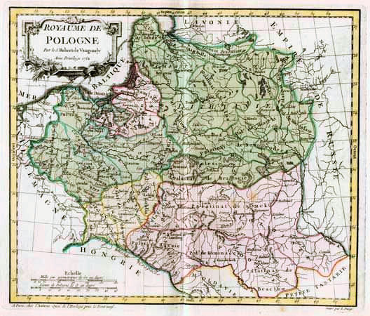
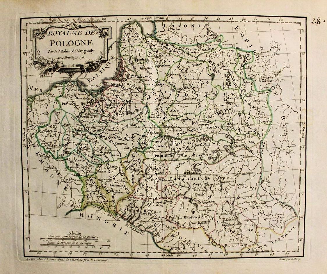
1762 [dated] Gilles Robert de Vaugondy: "ROYAUME de POLOGNE," 11 x 9 3/8 inches,
in three versions of the first state. Engraved by E. Dussy and the cartouche by Arrivet.
in three versions of the first state. Engraved by E. Dussy and the cartouche by Arrivet.


1756 Thomas Jeffreys (engraver) - Thomas Salmon
(historian): "Poland Lithuania and Prussia," London,
10.5 x 8 inches, in uncolored and colored versions from
the 4th edition of "A new geographical and historical
grammar..." Both cartouches are Type A. Uncolored map
from Albion Prints; colored map from d.raynes on eBay
(historian): "Poland Lithuania and Prussia," London,
10.5 x 8 inches, in uncolored and colored versions from
the 4th edition of "A new geographical and historical
grammar..." Both cartouches are Type A. Uncolored map
from Albion Prints; colored map from d.raynes on eBay

1757 Gilles Robert de
Vaugondy: "POLOGNE,'
Paris, from "Methode
abregee et facile pour
apprendre la Geograph-
ie." From cesgia on eBay
Vaugondy: "POLOGNE,'
Paris, from "Methode
abregee et facile pour
apprendre la Geograph-
ie." From cesgia on eBay


1760 J.H. Schneider -
Jean-Marie Bruyset: "XVII"
(Poland),Lyon, 17 x 10 cm,
from the first edition of the
school atlas "Atlas des
enfans.,” with unnamed
maps that required reading
text on the opposite page to
identify countries. Editions
were published in 1772 (at
this site), 1774, 1784 (on
this site), and 1790. From
mojo998stampeantiche

c. 1757 Georg C. Kilian
(publisher): "Geograph-
sche Vorstellung derer
Königreiche Polen..,"
Augsburg, reviving a
1700 Stridbeck plate,
later acquired/published
by Bodenehr in 1716.
Wroblewski Library of the
Lithuanian Academy of
Sciences: elibrary.mab.lt/
(publisher): "Geograph-
sche Vorstellung derer
Königreiche Polen..,"
Augsburg, reviving a
1700 Stridbeck plate,
later acquired/published
by Bodenehr in 1716.
Wroblewski Library of the
Lithuanian Academy of
Sciences: elibrary.mab.lt/

1760 Hiršas Leibovičius
(engraver): "Provincia
Lituana Ord. S.
Francisci..." (Orders of St.
Francis in the province of
Lithuania). From the
Wroblewski Library of the
Lithuanian Academy of
Sciences: elibrary.mab.lt/
(engraver): "Provincia
Lituana Ord. S.
Francisci..." (Orders of St.
Francis in the province of
Lithuania). From the
Wroblewski Library of the
Lithuanian Academy of
Sciences: elibrary.mab.lt/
c. 1762 Matthäus Seutter: "Novißima et accuratißima Magni Ducatus Magni Ducatus Lithuaniæ in suos Palatinaus
et Castellanias divisae Delineatio, cura et impressis Matthaei Seutteri, S. Caes. et reg. Cathol. Majest. Geogr. et
Chalcographi Augustani," Augsburg, 61.2 x 51.3 cm, in versions in the Third State, by virtue of the presence of the
"J.M. Probst" inscription under the top left frame line, noting Probst's purchase of half of Seutter's plates and printed
maps in 1762 from Seutter's widow.


1757 [dated] Jean-Francois Daumont (engraver/mapmaker) - Homann Heirs (publisher): "Les Royaumes de Pologne et
de Prusse Par Tobias Mayer..." Paris, 44.0 x 55.0 cm / 21 x 17 inches, in versions credited to a map by Tobias Mayer.
Daumont engraved playing cards and a few maps, typically based upon those of other mapmakers, 1750-60.
de Prusse Par Tobias Mayer..." Paris, 44.0 x 55.0 cm / 21 x 17 inches, in versions credited to a map by Tobias Mayer.
Daumont engraved playing cards and a few maps, typically based upon those of other mapmakers, 1750-60.
| 1760 www.swaen.com |


1763 Andrew Dury (mapmaker) - J. Ellis (engraver) - Robert Sayer (publisher): "Poland," London, with "La Pologne" above the frame, 11 x 13
cm, from a French version of Dury's 1761 English pocket atlas.
cm, from a French version of Dury's 1761 English pocket atlas.


1762 Thomas Kitchin - A. Millar (publisher): "A Map of the Kingdom of Poland, Drawn
from the Best Authorities," London, 10.3 x 8.7 inches, from Anton Friedrich Büsching's
"A New System of Geography...Carefully Translated from the last German Edition...in
six volumes. Volume the First: Denmark, Norway, Sweden, Russia and Poland."
from the Best Authorities," London, 10.3 x 8.7 inches, from Anton Friedrich Büsching's
"A New System of Geography...Carefully Translated from the last German Edition...in
six volumes. Volume the First: Denmark, Norway, Sweden, Russia and Poland."
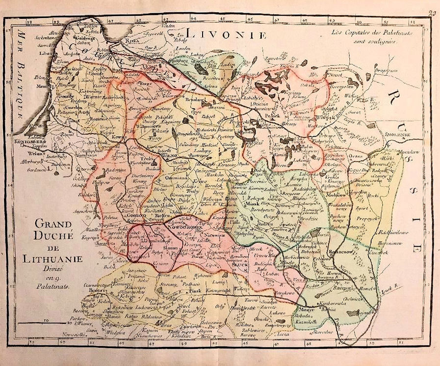
George Louis Le Rouge (publisher): "Grand Duché de Lithuanie,Divisé en 9 Palatinats," Paris, 9.25 x 13.5 inches, with
a [page] "23" above the top right frameline, from "Atlas Nouveau portatif, à l'usage des militaires et du voyageur,"
which also had editions in 1748 and 1767
a [page] "23" above the top right frameline, from "Atlas Nouveau portatif, à l'usage des militaires et du voyageur,"
which also had editions in 1748 and 1767


| Type "A" cartouche, London 7th edition: “The new geographical and historical grammar...” www.richardsmithrarebooks.com |
| Type "C" cartouche, Dublin 9th edition: "A new geographical and historical grammar..." |
1760 Thomas Jeffreys (engraver/geographer/publisher): "Poland Lithuania and Prussia,"
which he engraved for the first, 1749, edition of "A new geographical and historical
grammar..." by historian Thomas Salmon. Commonly said to have gone through 14
editions, my own research shows that there were at least 21 separate editions, the last in
1785. The only changes in that plate over 36 years were to the cartouche, which I
believe exists in four types, A, B, C, and D. Illustrations of each type, and the complete
publishing history of the map, are on the page "MapmakersG-L."
| 1762 Univ. of Tartu, Estonia: http://dspace.utlib.ee/ |


| www.albion-prints.com/ |
| d.raynes on eBay |
| 1757 www.alexandremaps.com |
| 1757 grafik-drucke on eBay.de |
| www.raremaps.com |
| www.ldfondas.lt/en/collection |
| Boston Public Library: Norman B. Leventhal Map Center http://maps.bpl.org |
| artlusatica on eBay |
| www.raremaps.com |
| Wroblewski Library of the Lithuanian Academy of Sciences: elibrary.mab.lt/ |
| www.davidrumsey.com |
| Cartographic and Geological Institute of Catalonia: http://cartotecadigital.icc.cat/ |
| National Library of France: www.gallica.bnf.fr |
1759 Claude Buffier - F.
Desbrulins (engraver) -
Pierre Faure (printer,
giving himself engraving
credit): "LA POLOGNE
Suivant les degrés de
l'Académie des Sciences
de Paris.” Beach Antique
Maps and Prints on eBay
Desbrulins (engraver) -
Pierre Faure (printer,
giving himself engraving
credit): "LA POLOGNE
Suivant les degrés de
l'Académie des Sciences
de Paris.” Beach Antique
Maps and Prints on eBay
| mappamundi-fr on eBay |
| www.gauss.suub.uni-bremen.de/suub/hist/index.jsp |
| www.alexandremaps.com |
| gkrgrec on eBay |
| cesgia on eBay |
| www.rare-atlases.com |
| www.miklianmaps.com |
| www.davidrumsey.com |
| 1st State www.antique-maps.lt |
| AK-16 |
| cesgia on eBay |
| cesgia on eBay |
| http://imago.by/map/ |
| www.senizemelepiai.lt |
| www.swaen.com |
| oldbooksoldmaps on eBay |
| www.karty.by |
| paulmapped on eBay |


| http://antique-maps.lt |
| www.swaen.com |


www.oldworldauctions.com
1762 Tobin Conrad Lotter
(engraver/publisher):
"Polonia Seraphico=
observans,"50 x 57.5 cm,
in the second state of this
plate, wherein Seutter's
name as publisher, as in
the 1753-55 version, has
been replaced by Lotter's.
From Antiquariat Nikolaus
Struck (Berlin) via
abebooks.com
(engraver/publisher):
"Polonia Seraphico=
observans,"50 x 57.5 cm,
in the second state of this
plate, wherein Seutter's
name as publisher, as in
the 1753-55 version, has
been replaced by Lotter's.
From Antiquariat Nikolaus
Struck (Berlin) via
abebooks.com

Harvard Map Library: https://ids.lib.harvard.edu

| www.rare-atlases.com |

1758 Claude Buffier - F.
Desbrulins (engraver) -
Giffart (publisher): "LA
POLOGNE suivant les
degrés de l'Académie des
Sciences de Paris.”
Desbrulins name is almost
erased.From www.beachmaps.
com
Desbrulins (engraver) -
Giffart (publisher): "LA
POLOGNE suivant les
degrés de l'Académie des
Sciences de Paris.”
Desbrulins name is almost
erased.From www.beachmaps.
com

| www.davidrumsey.com |
| www.swaen.com |


| www.raremaps.com |


| 2nd State Cartographic and Geological Institute of Catalonia: http://cartotecadigital.icc.cat |


c. 1761 Gilles Robert de Vaugondy: "Grand
Duché de Lithuanie,divisé par Palatinats,"
Paris, 16.4 x 21.3 cm, from "Bureau de
l'Atlas National." Plate is identical to that
dated "1749" in the cartouche. From Vilnius
Univ. Library: http://www.atmintis.mb.vu.lt/
Duché de Lithuanie,divisé par Palatinats,"
Paris, 16.4 x 21.3 cm, from "Bureau de
l'Atlas National." Plate is identical to that
dated "1749" in the cartouche. From Vilnius
Univ. Library: http://www.atmintis.mb.vu.lt/


| 2nd State www.raremaps.com |


1762 Jean Lattre
(publisher) - Giovanni
Rizzi-Zannoni (map-
maker): "La Pologne
Avec Priv. du Roi," Paris,
from "Atlas Geograph-
ique et Militaire." From
Osher Map Library:
https://oshermaps.org
(publisher) - Giovanni
Rizzi-Zannoni (map-
maker): "La Pologne
Avec Priv. du Roi," Paris,
from "Atlas Geograph-
ique et Militaire." From
Osher Map Library:
https://oshermaps.org

| Osher Map Library: https://oshermaps.org/ |
| 1756 napaliwali on eBay |

| 1756 www.antique-maps.lt |

| Bibliothèque nationale de France: www.gallica.bnf.fr |

| ww.swaen.com |

| www.raremaps.com |
| McMaster Univ. Library: https://digitalarchive. mcmaster.ca |

| c. 1757 www.landesarchiv-bw.de |

| 1759 Vilnaus Aukcionas: www.menorinka.lt |


| From a frequent visitor to this site |

| U. Michigan Clark Library https://quod.lib.umich.edu/ |

| 1759 Antiquariat Steffen Völkel GmbH, Nürnberg, via www.abebooks.com |

| www.polona.pl |

c. 1758-63 T.C. Lotter (engraver,
new publisher) - Matthaus Seutter:
"Poloniæ Regnum ut et Magni
Ducat. Lithuaniæ Accuratiss..,"
Augsburg, 7.5 x 10 inches, with
Lotter the new publisher under
the center frameline, and the coat
of arms of Augustus III. From cesgia
on eBay
new publisher) - Matthaus Seutter:
"Poloniæ Regnum ut et Magni
Ducat. Lithuaniæ Accuratiss..,"
Augsburg, 7.5 x 10 inches, with
Lotter the new publisher under
the center frameline, and the coat
of arms of Augustus III. From cesgia
on eBay

| 2nd State www.geographicus.com |

c. 1758 Claude Buffier - F. Desbrulins (engraver) -
Giovanni Zempel (publisher): "Polonia Secondo le
Osservazioni dell' Accademia di Parigi," Venice, 7 x 5.5
inches. Both from www.raremaps.com
Giovanni Zempel (publisher): "Polonia Secondo le
Osservazioni dell' Accademia di Parigi," Venice, 7 x 5.5
inches. Both from www.raremaps.com


| asjvince on eBay |
| www.raremaps.com |

| https://sammlungen.ulb.uni-muenster.de |

| 1st State www.lpmaps.lt |

| efi6 on eBay |


| www.swaen.com |


| 2nd State www.davidrumsey.com |
