Maps: 1777 - 1785

1778 Claude Buffier: "LA POLOGNE," Paris,
5.5 x 7 inches, from "Geographie
Universelle."Also a DETAIL image. From
www.cartographicarts.com
5.5 x 7 inches, from "Geographie
Universelle."Also a DETAIL image. From
www.cartographicarts.com
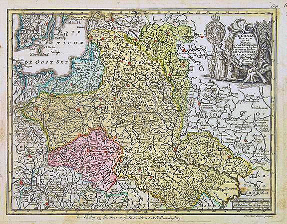
1778 Matthaus Seutter:
"POLONIAE REGNUM ut
et MAGNI DUCAT
LITHUANIAE..," Augs-
burg, engraved by T.C.
Lotter10.2 x 7.7 inches.
From www.swaen.com
"POLONIAE REGNUM ut
et MAGNI DUCAT
LITHUANIAE..," Augs-
burg, engraved by T.C.
Lotter10.2 x 7.7 inches.
From www.swaen.com

1780 Guillaume de L'Isle - Philippe Buache: "LA POLOGNE Dressee
sur ce qu'en ot donne Starovolsk, Beauplan, Hartnoch...," in two
versions, published 1773-80, Paris, 18.8 x 24.3 inches / 47.9 x 61.8
cm. The cartouche gives credit for the map to Guillaume Beauplan de
le Vasseur, Hartnoch and others. The copper plate shows many
erasures. The less-colored version and map detail is from Paulus Swaen:
www.swaen.com.
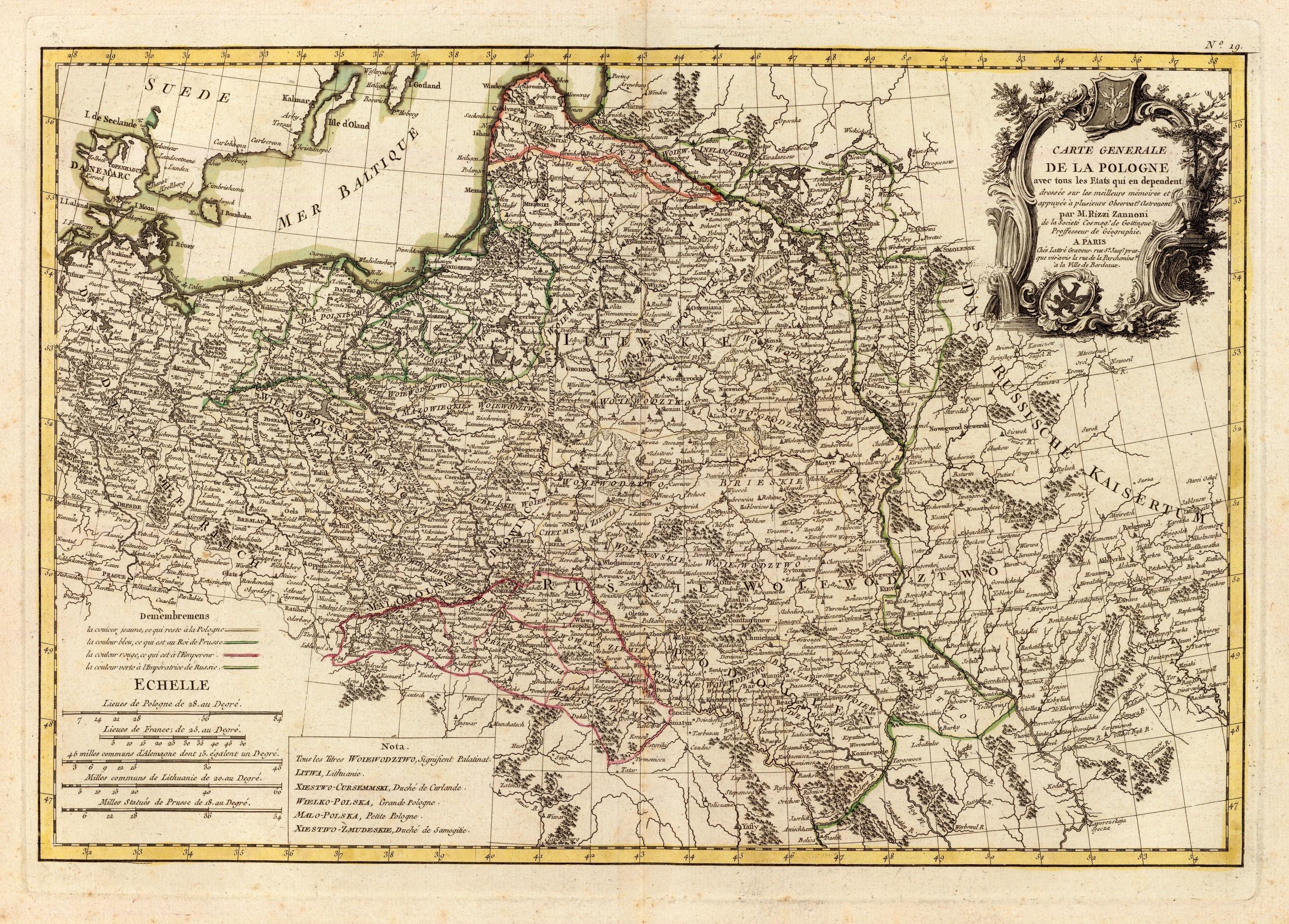
1780 Giovanni Antonio
Rizzi-Zannoni: "CARTE
GENERALE DE LA
POLOGNE...," Paris, 31 x
46 cm. An engraved map
lines, at 1:4 000 000.
From www.davidrumsey.com
Rizzi-Zannoni: "CARTE
GENERALE DE LA
POLOGNE...," Paris, 31 x
46 cm. An engraved map
lines, at 1:4 000 000.
From www.davidrumsey.com

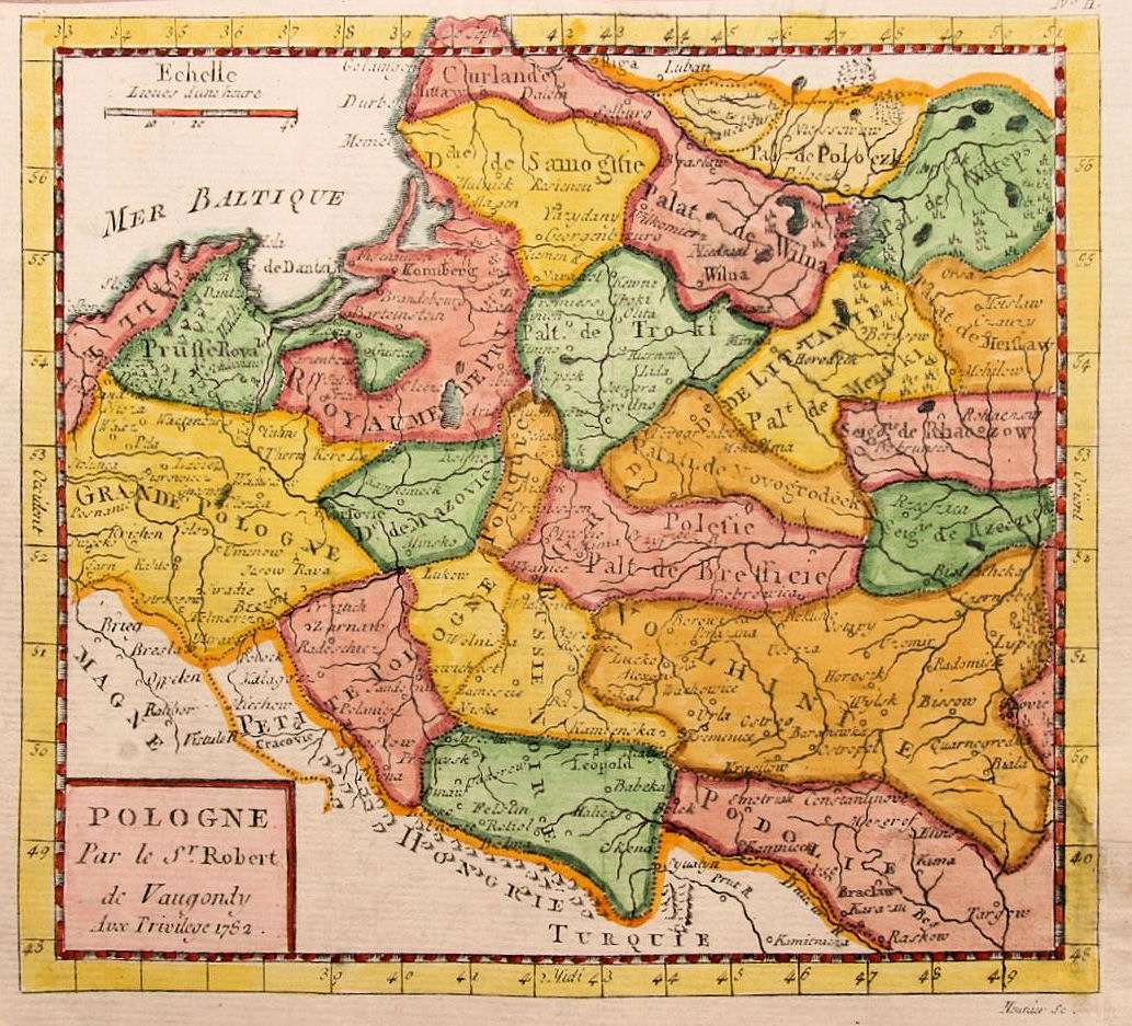
1780 Gilles Robert de
Vaugondy(also known as
Le Sieur or Monsieur
Robert): "POLOGNE."
18.5 x 16 cm. / 7.25 x
6.25 inches.
Vaugondy(also known as
Le Sieur or Monsieur
Robert): "POLOGNE."
18.5 x 16 cm. / 7.25 x
6.25 inches.

1780 Antonio Zatta: "IL
REGNO DI POLONIA...,"
Venice. 25.5 x 33.0 cm.
A smaller format than
the usual Zatta atlas
map -- this was probably
for a travel atlas.
REGNO DI POLONIA...,"
Venice. 25.5 x 33.0 cm.
A smaller format than
the usual Zatta atlas
map -- this was probably
for a travel atlas.
1781 - '82 Giovanni Antonio Rizzi-Zannoni (Cartographer) - Antonio Zatta (Publisher): "Atlante Polacco " (Atlas of Poland), Venice, from which these five maps came:

1782 John Abraham Bayly: "Poland," London, 220 x
275 mm, from William Frederick Martyn's
Geographical Magazine, in two differently-colored
versions. The map on the left: www.theprintscollector.com
275 mm, from William Frederick Martyn's
Geographical Magazine, in two differently-colored
versions. The map on the left: www.theprintscollector.com

1782 Louis-Charles Desnos: "LES ETATS DE LA COURONNE DE POLOGNE," Paris, 18.5 x
23.2 inches / 47.0 x 59.0 cm, in two different versions. This is a late state of a map first
published by by Nicolas De Fer in 1716 -- hence the clearly updated publish date in the
cartouche. First map from www.raremaps.com; second map and detail images from gkrgrec on eBay
23.2 inches / 47.0 x 59.0 cm, in two different versions. This is a late state of a map first
published by by Nicolas De Fer in 1716 -- hence the clearly updated publish date in the
cartouche. First map from www.raremaps.com; second map and detail images from gkrgrec on eBay


Gilles Robert de Vaugondy: "POLOGNE," 6 x 6 inches, in five differently-colored versions. The first two, both published 1781, still have a 1750 date
on them. The following three, all published 1782, all have an inexpertly changed date printed on the cartouche: 1782. The Vaugondys produced
many atlases from 1740 to the end of the century. Apart from the large 'Atlas Universelle' and the small 'Atlas Militaire', they allowed their maps
to be 'licensed' by others. Vaugondy maps, often dated 1750, were issued into the 1780's. Later editions had new maps engraved -- three above are
dated 1782 -- but they followed Vaugondy's outdated geography. The first, 1781 map, dated 1750, is from Beach Antique Maps & Prints, on eBay; the second 1781 map
is from bertius on eBay; then follow three 1782 versions, the last from www.mapandmaps.com

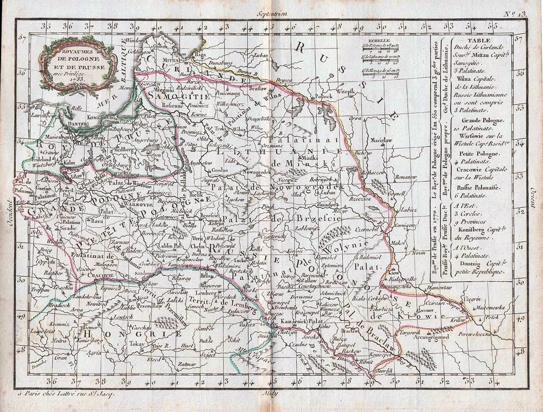
1783 Jean Lattre: "ROYAUMES DE POLOGNE ET DE
PRUSSE," Paris, 7 x 10 inches, in two versions. Map on
the right from Beach Antique Maps & Prints, on eBay
PRUSSE," Paris, 7 x 10 inches, in two versions. Map on
the right from Beach Antique Maps & Prints, on eBay
1783 Giovanni Antonio Rizzi-Zannoni:
"Carte Generale de la Pologne avec tous
les Etats qui endependent...," Paris, 17.5
x 12 inches. Compare with versions
published in 17721 and 1775. From
www.raremaps.com
"Carte Generale de la Pologne avec tous
les Etats qui endependent...," Paris, 17.5
x 12 inches. Compare with versions
published in 17721 and 1775. From
www.raremaps.com
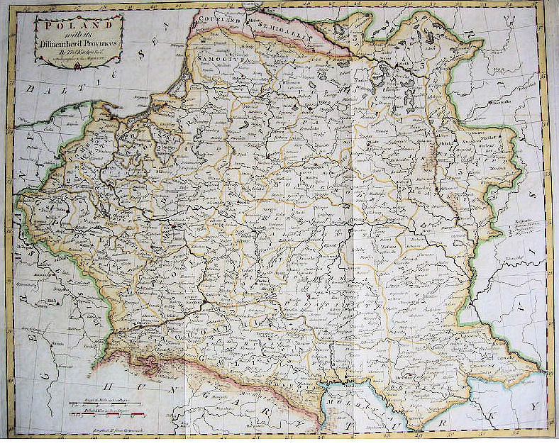
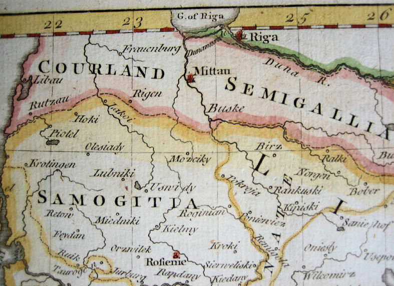
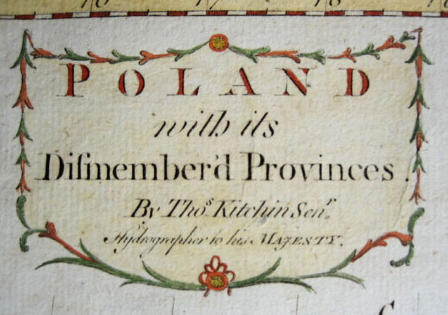
1784 Thomas Kitchin: "POLAND with its
Difmember'd Provinces." Also two DETAIL
images.
Difmember'd Provinces." Also two DETAIL
images.


1785 Jan Barend Elwe:
"LA POLOGNE DIVISEE
...," Amsterdam, 19.125 x
24.25 inches. From
www.alexandremaps.com
"LA POLOGNE DIVISEE
...," Amsterdam, 19.125 x
24.25 inches. From
www.alexandremaps.com
1785 Louis Brion de la
Tour: "CARTE DE LA
LITHUANIE, DE LA
COURLANDE, ET DE LA
NOUVELLE RUSSIE
BLANCHE, dismembre de
la Pologne," Paris, 9 x 11
inches. From
www.raremaps.com
Tour: "CARTE DE LA
LITHUANIE, DE LA
COURLANDE, ET DE LA
NOUVELLE RUSSIE
BLANCHE, dismembre de
la Pologne," Paris, 9 x 11
inches. From
www.raremaps.com

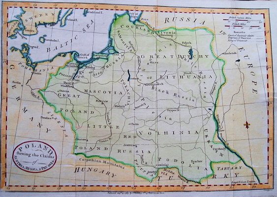
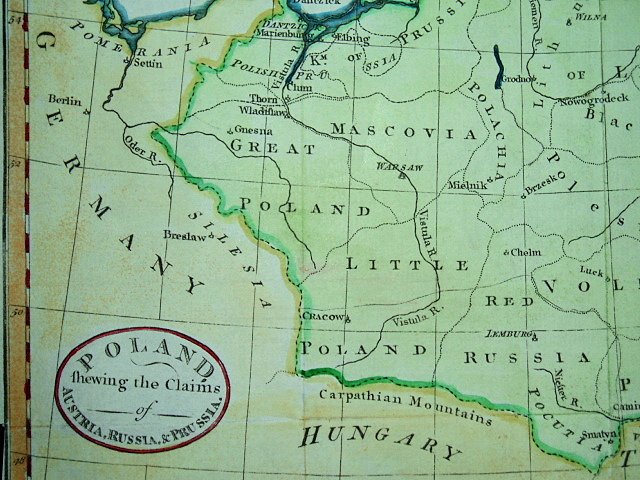
1785 C. Dilly & G. Robinson: "POLAND,
Shewing the Claims of RUSSIA, PRUSSIA &
AUSTRIA from the beft Authorities,"
London, 14 x 12 inches. From
www.raremaps.com
Shewing the Claims of RUSSIA, PRUSSIA &
AUSTRIA from the beft Authorities,"
London, 14 x 12 inches. From
www.raremaps.com

1783 Didier Robert de Vaugondy: "LE ROYAUME DE
POLOGNE divise en Duches et Provinces...," Paris,
50.0 x 56.0 cm., showing, despite the publication
date, boundaries before the First (1772) Partition. The
cartouche credits him as "geographer," but without
the title: "Geographe ordinaire du Roi. Avec Privilege "
(Geographer to the King, title granted 1752). From
www.alteagallery.com
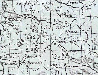
| "Li PALATI- NATI di WILNA, TROKI, INFLANT coi Ducati di Kurlandia E Smudz..." 12.5 x 16.5 inches. From www. raremaps.com and AK-06 |

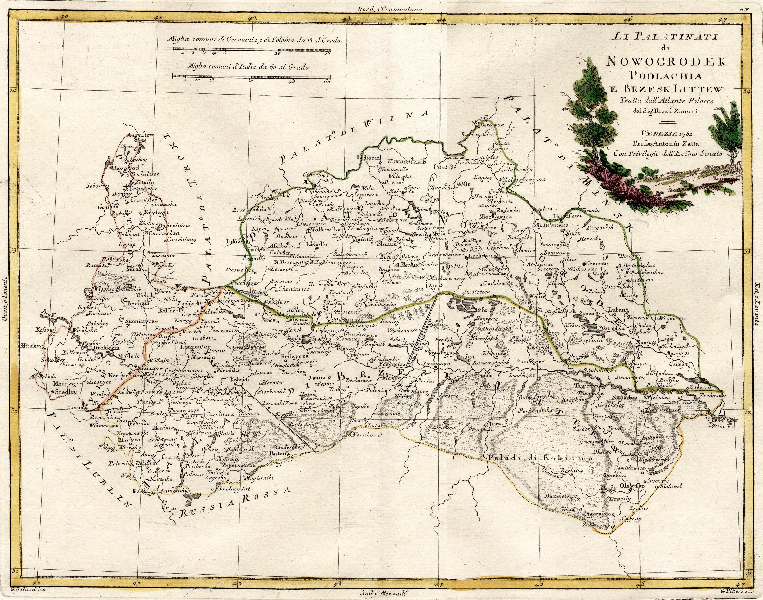
"NOWOGRODEK,
POLACHIA e BRZESK
LITTEW" From wikimedia
POLACHIA e BRZESK
LITTEW" From wikimedia
"MINSK, MSCISLAW,
POLOK e WITEBSK,
NELLA LITTUANIA,"
16.5 x 12.5 inches
POLOK e WITEBSK,
NELLA LITTUANIA,"
16.5 x 12.5 inches

1785 Thomas Kitchin:
"POLAND, LITHUANIA
and PRUSSIA. drawn from
the latest Authorities," 7 x
8.5 inches, from Guthries
"Geographical Grammar."
From http://stores.ebay.com/
bertius?_trksid=p4340.l2563
"POLAND, LITHUANIA
and PRUSSIA. drawn from
the latest Authorities," 7 x
8.5 inches, from Guthries
"Geographical Grammar."
From http://stores.ebay.com/
bertius?_trksid=p4340.l2563

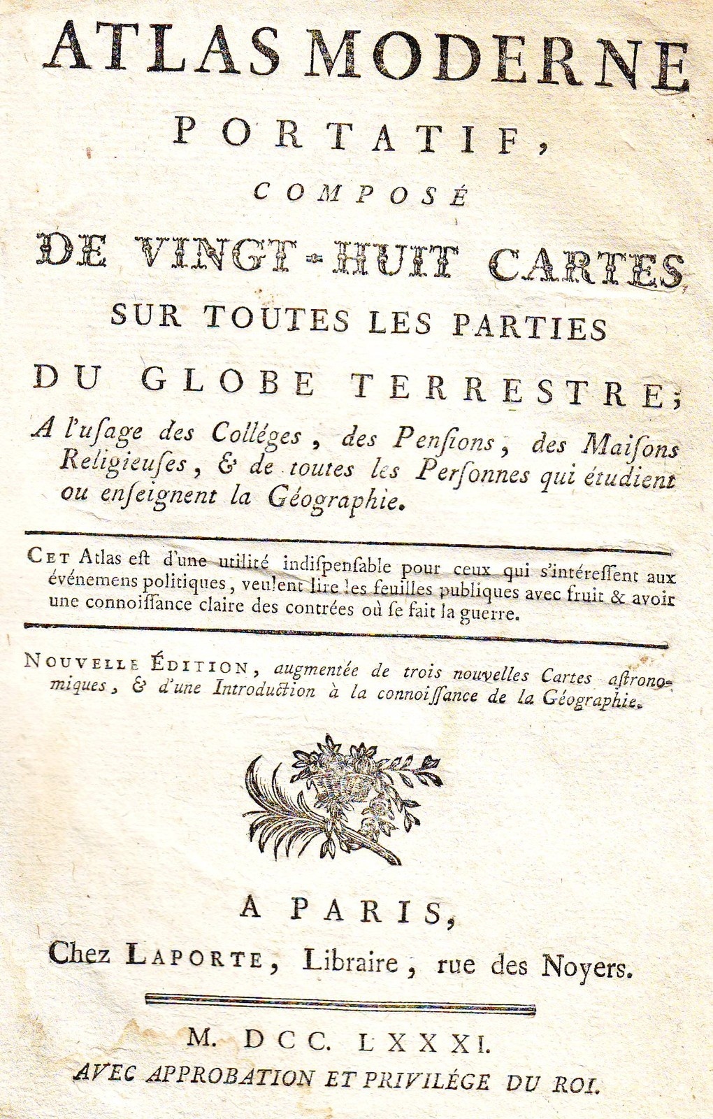
1781 Joseph de Laporte (publisher):
"POLOGNE," from his "Atlas Moderne
Portatif," Paris, first published in 1780, with
additional editions in 1786, 1801 and 1814.
The title page is to the right.
"POLOGNE," from his "Atlas Moderne
Portatif," Paris, first published in 1780, with
additional editions in 1786, 1801 and 1814.
The title page is to the right.


1782 John Fielding (publisher) - John Cary
(carto- grapher/engraver): "A New Map of
POLAND from the lateft Obfer.," London, 7.5 x
11 inches / 19 x 28 cm. From www.swaen.com
(carto- grapher/engraver): "A New Map of
POLAND from the lateft Obfer.," London, 7.5 x
11 inches / 19 x 28 cm. From www.swaen.com
1782 John Fielding (publisher): "POLAND,
shewing the claims of AUSTRIA, RUSSIA
& PRUSSIA," and two DETAIL images from
an eBay auction
shewing the claims of AUSTRIA, RUSSIA
& PRUSSIA," and two DETAIL images from
an eBay auction


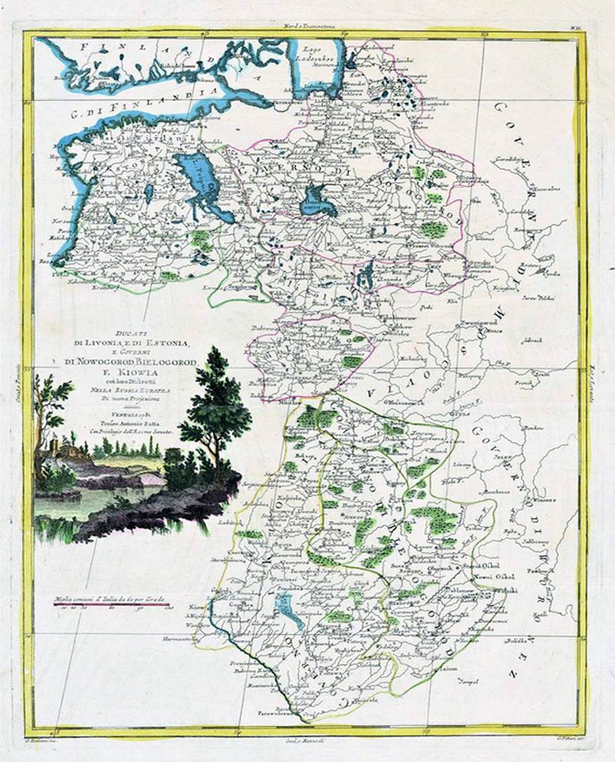
1785 Antonio Zatta:
"DUCATI DI LIVONIA,
E DI ESTONIA E
GOVERNI NOWO
GOROD, BIELOGOROD
...NELLA RUSSIA
EUROPEA..." Venice,
31 x 41 cm, dated
1882, published in
"Atlante Novissimo."
From the National Library
of Estonia:
www.nlib.ee/html/digi/maps
"DUCATI DI LIVONIA,
E DI ESTONIA E
GOVERNI NOWO
GOROD, BIELOGOROD
...NELLA RUSSIA
EUROPEA..." Venice,
31 x 41 cm, dated
1882, published in
"Atlante Novissimo."
From the National Library
of Estonia:
www.nlib.ee/html/digi/maps

1784 John Abraham Bayly: "A
NEW MAP OF POLAND,"
London, 10.5 x 8 inches, from
the 1784 version of William
Frederick Martyn's Geograph-
ical Magazine. From Beach Antique
Maps & Prints on eBay
NEW MAP OF POLAND,"
London, 10.5 x 8 inches, from
the 1784 version of William
Frederick Martyn's Geograph-
ical Magazine. From Beach Antique
Maps & Prints on eBay
1780 Jean Janvier - Jean
Lattre: "LES ROYAUMES
DE POLOGNE ET DE
PRUSSE, AVEC LE DUCHE
DE CURLANDE..." Paris,
25.5 x 18.5 inches. Also
three DETAIL images.
First issued 1760,
updated through 1780.
(See the 1774 version on
the previous page.) From
cesgia on eBay
Lattre: "LES ROYAUMES
DE POLOGNE ET DE
PRUSSE, AVEC LE DUCHE
DE CURLANDE..." Paris,
25.5 x 18.5 inches. Also
three DETAIL images.
First issued 1760,
updated through 1780.
(See the 1774 version on
the previous page.) From
cesgia on eBay


1779 Thomas Bowen:
"POLAND, LITHUANIA
AND PRUSSIA," London,
7 x 8.625 inches.
Compare with 1773
version. From
fineantiquemaps on eBay
"POLAND, LITHUANIA
AND PRUSSIA," London,
7 x 8.625 inches.
Compare with 1773
version. From
fineantiquemaps on eBay

1782 Thomas Kitchin:
"POLAND, LITHUANIA
and PRUSSIA," Edinburgh,
7 x 8.5 inches. From Beach
Antique Maps & Prints on eBay
"POLAND, LITHUANIA
and PRUSSIA," Edinburgh,
7 x 8.5 inches. From Beach
Antique Maps & Prints on eBay

1784 J.H. Schneider -
Jean-Marie Bruyset:
"XVII" (Poland & Lithu-
ania) Lyon, 10 x 12 cm,
from "Atlas des enfans, ou
nouvelle methode pour
apprendre la Geographie."
From www.davidrumsey.com
Jean-Marie Bruyset:
"XVII" (Poland & Lithu-
ania) Lyon, 10 x 12 cm,
from "Atlas des enfans, ou
nouvelle methode pour
apprendre la Geographie."
From www.davidrumsey.com


1785 Samuel J. Neele (engraver): "PRESENT
POLAND, PRUSSIA &s," London, 12.5 x 7.5
inches / 32 x 19 cm, copper engraving
published by T. Stackhouse. Also a DETAIL
image. The Neele family were engravers and
publishers who worked with and for many
other publishers: Faden, Laurie, Leard,
Playfair and Thomson, among others. From
old-leaf on eBay


1782 Thomas Kitchin:
"POLAND, LITHUANIA
and PRUSSIA," From
www.orteliusmaps.org
"POLAND, LITHUANIA
and PRUSSIA," From
www.orteliusmaps.org

1778 Tobias Conrad Lot-
ter: "Magnus ducatus
Lithuania..." Augsburg,
from his "Atlas geograph-
ique." From Library of Con-
gress,Geography and Map Div.
ter: "Magnus ducatus
Lithuania..." Augsburg,
from his "Atlas geograph-
ique." From Library of Con-
gress,Geography and Map Div.

1780 Gilles Robert de
Vaugondy: "CURLANDE,
LIVONIE, INGRIE..." From
Cartographica Neerlandica at
orteliusmaps.com
Vaugondy: "CURLANDE,
LIVONIE, INGRIE..." From
Cartographica Neerlandica at
orteliusmaps.com


1782 Louis Delarochette: "Map of the Empire
of Germany: Including All the States Com-
prehended Under that Name with the King-
dom of Prussia, " from Kitchen’s "General
Atlas." The World Digital Library: www.wdl.org
of Germany: Including All the States Com-
prehended Under that Name with the King-
dom of Prussia, " from Kitchen’s "General
Atlas." The World Digital Library: www.wdl.org
"DUCATI di LIVONIA, e di ESTONIA, e Governi
di NOWO- GOROD, BIELOGROD e KIOWA"
di NOWO- GOROD, BIELOGROD e KIOWA"


1780 Crepy Family:
"CURLANDE et SEMIGAL,
Partie Orientale," Paris.
From orteliusmaps.org
"CURLANDE et SEMIGAL,
Partie Orientale," Paris.
From orteliusmaps.org
1781 (1750) 1781 (1750) 1782 (1782) 1782 (1782) 1782 (1782)


1782 Thomas Kitchin : "POLAND, LITHU-
ANIA and PRUSSIA," London, 6.8 x 8.3
inches, engraved by Kitchin. Also a DETAIL
image. From www.swaen.com
ANIA and PRUSSIA," London, 6.8 x 8.3
inches, engraved by Kitchin. Also a DETAIL
image. From www.swaen.com

1780 ""Могилевскаго..."
(Mogilev gubernia), formed
in 1772, after the First
partition of the Grand
Duchy, from parts of the
provinces of Witebsk,
Mścisław, Połock and
Polish-Lithuanian
Livonia. All in Cyrillic,
with a lovely cartouche.
From radzima.net
(Mogilev gubernia), formed
in 1772, after the First
partition of the Grand
Duchy, from parts of the
provinces of Witebsk,
Mścisław, Połock and
Polish-Lithuanian
Livonia. All in Cyrillic,
with a lovely cartouche.
From radzima.net


1783 Lt. Commander Sergey Pleshcheyev:
"Travel map of Imperial Highness the Grand
Duke Paul and Grand Duchess Maria
Feodorovna ... in 1781 and 1782 respectively /
composition according to the latest observa-
tions of the longitude and latitude of the most
illustrious in Europe in the former site of the
retinue of their Imperial Highnesses," St
Petersbug, 108 х 134 cm. Clearly, inspect-
ing the lands newly annexed by Russia from
the Grand Duchy of Lithuania following the
First Partition of 1772. From the National
Library of Russia: http://leb.nlr.ru/collections/42/


"La Polonia Divisa ne’suoi
Palatinati Tracta dall'
Atlante Polacco…" 32.5 x
42 cm. From sda.pl - Sopocki
Dom Aukcyjny
Palatinati Tracta dall'
Atlante Polacco…" 32.5 x
42 cm. From sda.pl - Sopocki
Dom Aukcyjny


1783 W.A. Bachiene - J. van Jagen - Emanuel Bowen:
"Nieuwe en naauwkeurige kaart van 't Koningrijk
Polen en 't Groot Hertogdom Lithauwen..." (New and
accurate map of the Kingdom of Poland and the Grand
Duchy of Lithuania...) Amsterdam, 34 x 42 cm. From
auctiona.catawiki.com
"Nieuwe en naauwkeurige kaart van 't Koningrijk
Polen en 't Groot Hertogdom Lithauwen..." (New and
accurate map of the Kingdom of Poland and the Grand
Duchy of Lithuania...) Amsterdam, 34 x 42 cm. From
auctiona.catawiki.com


1781 Rigobert Bonne -
Grenet: "Carte du
Royaume de Pologne et et
du Grand Duche de
Lithuanie," from Grenet's
"Atlas Portatif." From
aproposdefleurs* on eBay
Grenet: "Carte du
Royaume de Pologne et et
du Grand Duche de
Lithuanie," from Grenet's
"Atlas Portatif." From
aproposdefleurs* on eBay